


More about
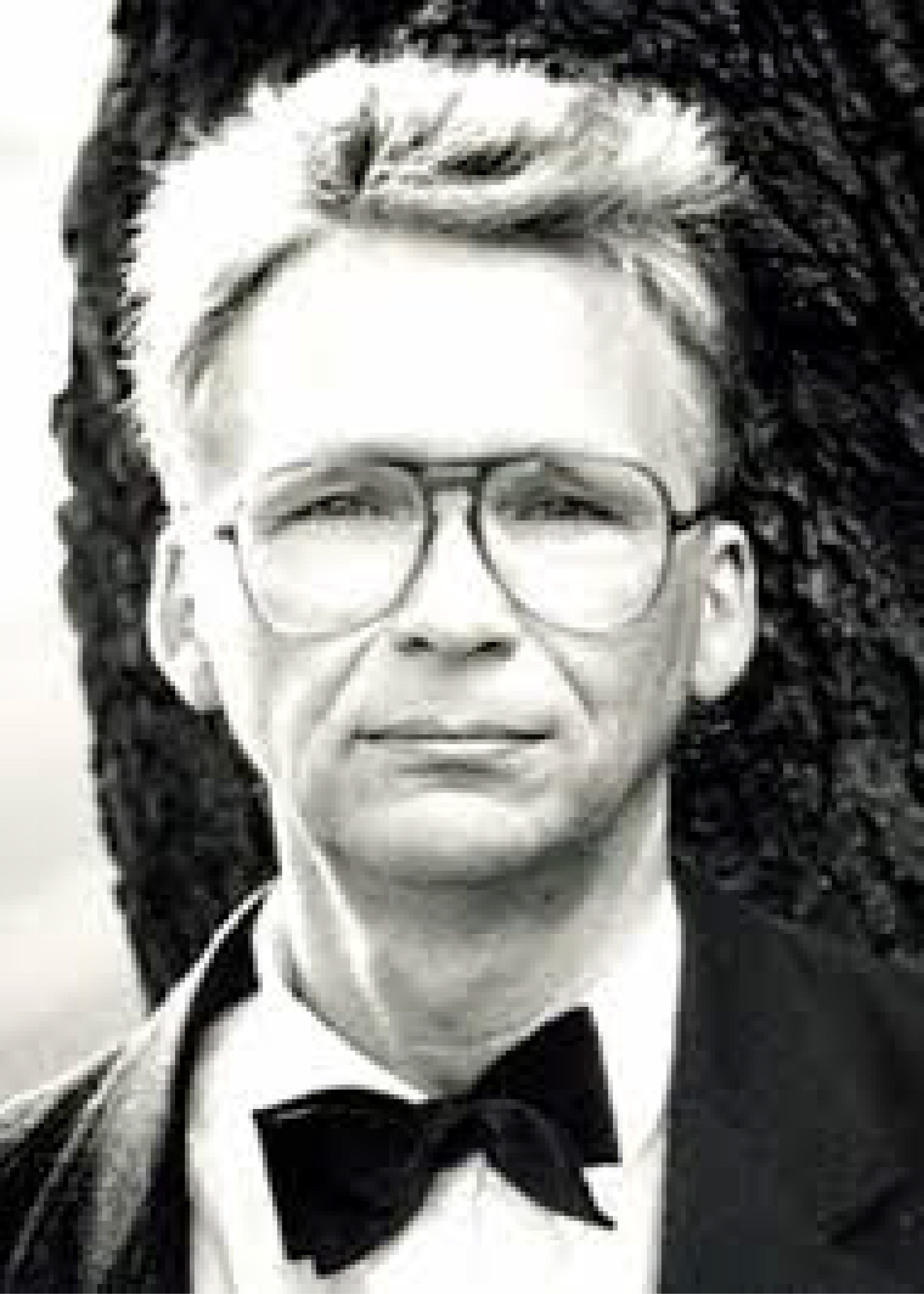
 Evangelos Livieratos (1948) is professor emeritus of the Faculty of Engineering, Aristotle University of Thessaloniki (AUTH). Elected full-professor (1979) at the Chair of Higher Geodesy and Cartography, School of Rural and Surveying Engineering, Faculty of Engineering, AUTH – serving until August 31, 2015. He was full member of the School's Department of Geodesy and Surveying and member of the Department of Cadastre, Photogrammetry and Cartography – for research and teaching. Author, organiser and elected Chair of the Commission on Cartographic Heritage into the Digital of the International Cartographic Association with four mandates (2005-2019). Founder and editor of the international web journal e-Perimetron on sciences and technologies affined to history of cartography and maps (2006- ). Member of the CartoGeoLab AUTH - Laboratory of Cartography & Geographical Analysis and member of the Advisory Board 'Geodesy' of the Bavarian Academy of Sciences (2016- ). Fellow of the International Association of Geodesy (1999). Honorary Fellow of the International Cartographic Association (2019).
Career periods
The first period of his academic career, starting in the early 1970s, was dedicated to the field of geodesy shifting gradually to cartography from the mid-1980s and totally from the mid-1990s, keeping however alive, in his scientific and engineering reasoning, the gained geodetic thinking thanks to his academic teachers.
Engineering + Humanities
Besides his core activities in geospatial sciences and engineering, particularly in mapping, his long-lasting interest for arts and humanities (i.e. history, literature, theatre, cinema) offered the grounds for developing, from the mid-2000s, a line of thought converging to cartographic heritage, a field coupling the historic and cultural heritage of maps and mapping, including cartographic miracula and parapherna(lia) of the past, with the so far integration into the dominant digital mainstream.
Vision
His strong vision for 21st century is a creative rapprochement of engineering with humanities, and vice-versa, designed the rapprochement to be open-minded, tolerant, pluralist, extrovert, fresh and attractive in order to develop composite common areas of thinking, study, research and scientific growth for the benefit of both, humanities and engineering, in a world embedded more and more into the digital manifold.
Studies
After completing his secondary education in Athens, at the First Highschool of Plaka (1965), he got an engineering degree (Dipl. Eng.) in Rural and Surveying Engineering from the National Technical University of Athens (1970), a Doctor of Engineering degree (Dr Eng.) from National Technical University of Athens (1974) with Prof. George Veis and a Doctor of Philosophy degree (Fil. Dr) in Mathematical, Physical and Natural Sciences from Uppsala University (1976) with Prof. Erik Tengström. In 1978 he was awarded the academic title of Docent of the National Technical University of Athens for his docentship dissertation 'Differential Geometry Implementation in Geodesy, Geophysics and Cartography'.
Fellowships
He received research fellowships from the Alexander von Humboldt Stiftung, Germany (twice); the Smithsonian Research Foundation, USA; the National Research Foundation, Sweden; the Geodetic Commission of Italy; the Delft University of Technology Research Committee, Netherlands.
Major career achievement
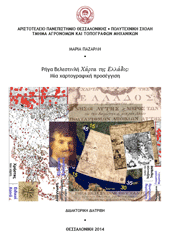
A career achievement with reference to the history of Greek Cartography and of the Modern Greek Enlightenment is his discovery in 2008 of the existence of two versions of Rigas Velestinlis monumental Charta of Greece, with variants, by using comparative digital analytical and visualisation methods and techniques. The existence of the two main versions of Rigas Charta was unknown to the historians since 1797.
Research
Even before his graduation he worked with George Veis, assisting the research at the Laboratory of Surveying (later Higher Geodesy and Cartography) and at the Dionysos Satellite Tracking Center of the National Technical University of Athens (1969-1978). Later he worked on the terrestrial applications of satellite geodesy, electronic distance measurements and gravimetry and assisted G. Veis' research on Standard Earth Models and satellite geodesy at the Smithsonian Astrophysical Observatory (SAO), Cambridge MA in the early 1970s (Smithsonian Year; NASA's Archive, Space Geodesy Data). In the mid-1970s at Uppsala he worked with Prof. Tengström in high satellite orbit determination and in geodynamical models including sea-tides. He worked intesively on intrinsic 3D geodesy with the Linceian Academician Prof. Antonio Marussi, University of Trieste (1976-1980) and on relevant differential geodesy of the gravity field issues with Prof. Erik Grafarend in Munich and Stuttgart (mid 1970s, mid 1980s). After his academic association with the Aristotle University of Thessaloniki in 1979, as Professor of Higher Geodesy and Cartography, his research activity in the 1980s was shared between geodetic and cartographic issues, focusing gradually on cartography, mapping and geospatial representation after the mid 1980s becoming his main and systematic research topic in the 1990s and especially from the mid-1990s to the presend-day. His numerous scientific works are published in Greek and international journals (e.g. Geophysical Journal of the Royal Astronomical Society; Reviews of Geophysics and Space Physics; Bollettino di Geofisica Teorica ed Applicata; Bolletino di Geodesia e Scienze Affini, Tectonophysics, Acta Geophysica Polonica; Bulettin Géodésique; Manuscripta Geodaetica; The Cartographic Journal; Cartographica; International Journal of Cartography), also in books, proceedings, honorary and collective volumes. Of particular importance in developing a "new" School of thinking in matters of geo-disciplines at Thessaloniki, throughout the course of the 1980s, was his close partnership, concert and fruitful cooperation with the coeval colleague and friend Athanasios Dermanis who was invited to join the Aristotle University becoming a full-professor just few years later, in 1982.
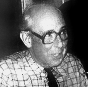
The 1980s: Athanasios Dermanis and Evangelos Livieratos academically pleased lecturing in Sicily! |
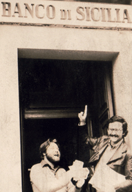 |
With Dermanis in common gait, sharing academic visions, energy, efforts, strains and joys, satisfactions and disappointments, many innovative things succeeded at that time in research, teaching, implementation and diffusion with strong extroversity and international mobility. The golden 1980s!
Teaching
He offered undergraduate and graduate courses in various branches of geodesy and cartography: at the National Technical University of Athens (ellispoidal geodesy, physical geodesy and gravimetry, thematic cartography); at the Aristotle University of Thessaloniki (ellipsoidal geodesy, theory of geodesy, general cartography, thematic cartography, mathematical cartography, sciences and technologies of mapping engineering, non-conventional cartography); at the University of West Macedonia, School of Education, a course on map-design, map-use and map-reading for teachers for assisting lessons in class with maps, 1991; at the Democritos University of Thrace, School of Architecture (mapping technologies for architects). As visiting professor he offered undergraduate integrated courses and seminars at: the University of Bologna, Faculty of Engineering, for students in Civil Engineering and Mining Engineering; at the Deflt University of Technology for students in Geodetic engineering; at the University of Pavia, Faculty of Engineering, at the Faculty of Architecture and Society in Mantua, Italy. Also he addressed post-graduate seminars: at the University of Uppsala, Geodetic Institute; at the International School for Advanced Studies (SISSA) of Trieste; at the International Centre "Ettore Majora" (CCSEM) of Erice. In 2016 he was appointed visiting professor of the Department of Architecture, Construction, Conservation (DACC), University Iuav of Venice. In 2018 he addressed lectures to the Cartography M.Sc. Erasmus Mundus International Master of Science Programme at the Technical University of Vienna.
Mentorship
He assigned, supervised and examined many doctoral dissertations in Greece and abroad (Stuttgart, Delft, Milan-Venice); he offered a great number of lectures internationally; he served as external evaluator of competitive research project proposals administrated by relevant state research agencies of three EU countries. A number of his Greek and foreign students are now academically in charge in Greece, Italy, France, Canada, Netherlands and Switzerland.
International associations
In the frame of his association with the International Association of Geodesy (IAG) and with the International Cartographic Association (ICA) he served respectively as the President of the IAG Working Group Differential geometry of the gravity field (late 1970s) and as the Chair of the ICA Working Group Digital Technologies in Cartographic Heritage (2005-2007). In 2007 the ICA General Assembly (Moscow) elected him Chair of the ICA Commission on Digital Technologies in Cartographic Heritage for the term 2007-2011. In 2011 the ICA General Assembly (Paris) reelected him Chair of this Commission for a second term, to 2015. In 2015 the ICA General Assembly (Rio de Janeiro) elected him for a third term to Chair the Commission under the new name Cartographic Heritage into the Digital, to 2019.
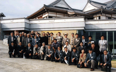
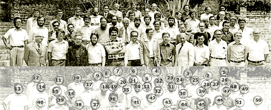
Gifu, Japan, 1996: ICA Joint Seminar Cognitive maps and children; ICA Commission on Theoretical Cartography
Innovative projects
From the early 1980s he is developing at Thessaloniki computer-aided cartography, digital methods for map-analysis and map production. The very first applications, in Greece, of analytical methods in the study of the geometric content and deformations of historical maps have the origins at that time in the AUTH School of Rural and Surveying Engineering. In 1996 he pioneered in Greece systems of map design and map production for the visually impaired, based on digital settings and technologies. With his associates Prof. Chrysoula Boutoura (AUTH) and the Doctoral student Kostas Papadopoulos (now professor at the University of Macedonia, Thessaloniki) he implemented relevant innovative interfaces in the Braille tactile system. In 1999 the first prototype City Atlas for the Visually Impaired in Greece, implemented for the City-Centre of Thessaloniki, was assigned to the authorities of the Hellenic Ministry of Macedonia – Thrace.
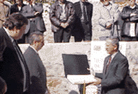 |
The assignment of the tactile Atlas of Thessaloniki to the Hellenic Ministry of Macedonia-Thrace, 1999 |
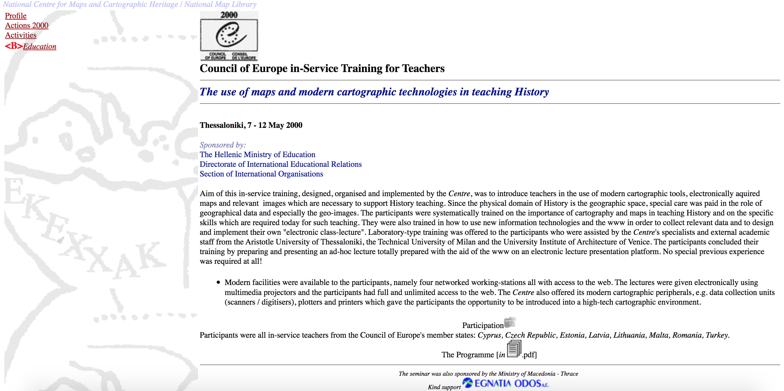
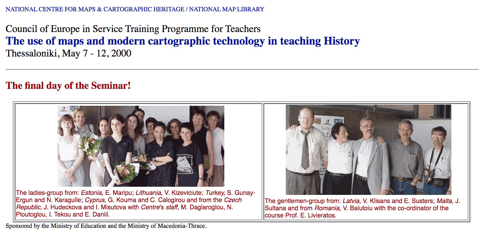
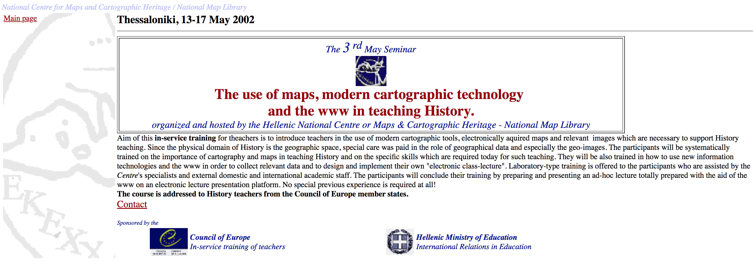
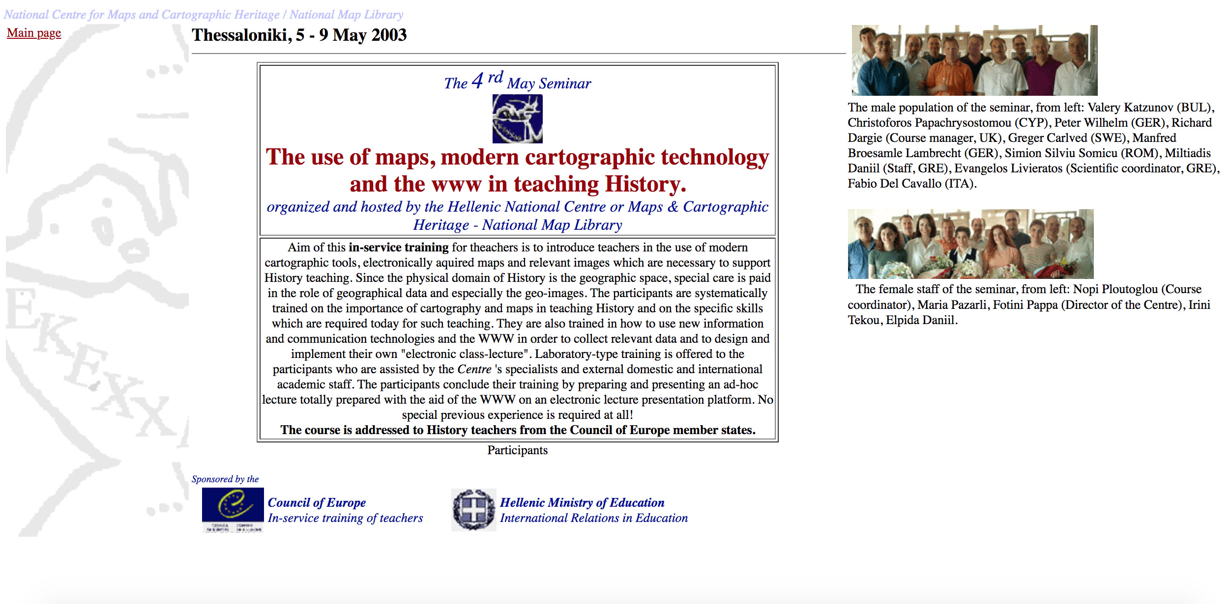
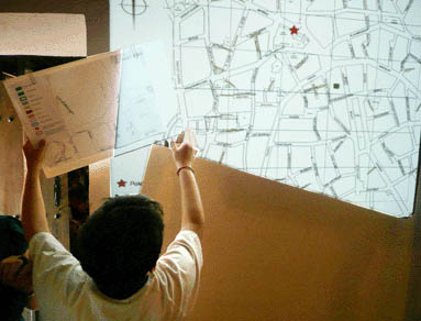
He designed, organized and coordinated at Thessaloniki the European series of Seminars on The use of maps, modern cartographic technology and the web in teaching History approved, supported and jointly sponsored by the Council of Europe, the Hellenic Ministry of Education and the National Centre for Maps and Cartographic Heritage. A four-years project, 2000-2003, [1] [2] [3] [4] in the frame of the Council of Europe's In-service Training for Teachers initiative, was addressed to teachers coming mainly from the new Council of Europe’s member-states but also from older member-states. Since 2006 he is the designer and the main organiser of the on-going annual international Workshops on Digital Approaches to Cartographic Heritage, a 10-years long cooperative international initiative with horizon beyond 2015. The past events held at Thessaloniki (2006 and 2019); Athens (2007); Barcelona (2008-2012); Venice (2009-2017); Vienna (2010); The Hague (2011); Rome (2013); Budapest (2014); Corfu (2015); Riga (2016); Madrid, 2018 in association respectively with the Museum of Byzantine Culture; the Hellenic National Research Foundation; the Cartographic Institute of Catalonia; the University IUAV of Venice; the Technical University of Vienna; the National Archives of the Netherlands; the Italian Geographical Society; the Eötvös Loránd University in Budapest; the Ionian University in Corfu; the National Library of Latvia; the National Geographical Institute of Spain.
 |
The Kozani innovative project (2008-2010) put the basis for applying a manifold of initiatives and synergies with the local society and schools, as it was e.g. the well organized series of Sunday-lectures for the general public (the Sundays at the Map Library project), the cartographic action-game for school-children Mapping my city! and other relevant events |
He was the head of the innovative research project-consortium (2008-2010) of the AUTH, the City of Kozani and the 17th century rooted historic Kozani Municipal Library, for the setting-up and the development of the Kozani Map Library in the context of the new Municipal Library (with a modern building currently under construction, expected to be ready by the end of 2015). This Library is planned to function as a innovative social, cultural and economic growth-factor institution for the region of Kozani the years to come aspiring a strong national and international resonance. From 2016 he is actively cooperating with the AUTH Library & Information Centre on cartography and map issues, as a member of the Library's partner AUTH CartoGeoLab.
Establishing new institutions
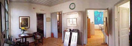
He is the founder of the Hellenic Cartographic Society (1994), the ICA member for Greece. As the Society's first President (1994-1999) introduced the National Cartographic Conferences, annual from 1994 to 2000 and biannual since then, counting 13 Conferences held regularly in 12 cities all-over Greece. Direct output of was the relevant series of the Conference Proceedings, 12 volumes published so far, edited mostly by Prof. Myron Myridis, the second President of the Society (2000-2008). In 1997 he designed, proposed and carried out the foundation of the National Centre for Maps and Cartographic Heritage – National Map Library at Thessaloniki a public institution under private law, oriented to the Digital, a unique institution of this type for Greece.
The project was approved unanimously by the Hellenic Parliament and the new cartography based Centre (under his leadership from 1997 to 2006 and from 2011 to 2013) was active and productive nationally and internationally until 2013, when it was incorporated as a unit in the General State Archives of Greece, the Archives of Cartographic Heritage.
Scientific journals - editorial projects
From its establishment in the mid-1970s and for many years he worked actively in the editorial board of the international journal Manuscripta Geodaetica, which became the official journal of the International Association of Geodesy (IAG) merged later with Bulletin Géodésique to form the Journal of Geodesy. In the 1980s he was the founder and the editor of two Greek journals on geospatial issues, with international circulation, Quaterniones Geodaeticae and Eratosthenes; very many present-day academics in Greece, active in the field of geomatics and geospatial engineering, found scientific floor in these two journals at the first steps of their careers. From 2007 he is managing the editorial project "Trips with maps to places (topos) and utopiae (u-topos)" published (in Greek) by the Ziti Editions, Thessaloniki. He is the founder, in 2006, and the coordinating editor of the free access international web journal e-Perimetron for sciences and technologies affined to the history of cartography and maps, founded with co-editorial participation from Italy, France, Netherlands, Spain and Greece. Member of the editorial board of the International Journal of Cartography published on behalf of ICA by Taylor & Francis.
University administration - policy making
He chaired the AUTH School of Rural and Surveying Engineering (1987-1989; 1989-1991), and served as the Director of the School's Departments of Geodesy and Surveying and of Cadastre, Photogrammetry and Cartography. He was also member of the AUTH Senate. As a member (1982-1987) of the Governing Committee of the new Technical University of Crete (TUC), at Chania, he proposed in 1983 the establishment of the School of Mineral Resources Engineering as well as the profile of the School’s three Divisions: of Exploration and Positioning; of Mining Technology; of Minerals Exploitation. He took also the initiatives for the introduction of a teaching and research permanent appointment relevant to Geodetic positioning and Geomatics. On behalf of the TUC's Governing Committee he followed closely and actively the first phase of this School growth.
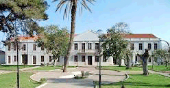 |
One of the buildings hosting the first operation of the Technical University of Crete, at Chania, in the early-mid 1980s |
He took part in groups of experts appointed by the Ministry of Education of Greece for the study of various university issues and he actively participated from 1994 to 2002 in the Council of Europe’s Higher Education and Research Committee (HER) as an academic member of the HER General Assembly. In the frame of CoE - HER he took part in groups of experts and in specialised HER seminars and conferences (Strasbourg, Paris, Malta, Ankara, Catania) mainly for issues related to Research, Access in Higher Education and the Life Long Learning project (1997-2001). He was a key-speaker at the final conference of the CoE programme Life Long Learning for Equity and Social Cohesion, Sorbonne (November 2001).
In 1998 he was elected by the HER General Assembly member of the HER Bureau in Strasbourg with two years mandate (1998-2000), re-elected in 2000 for a second term (2000-2002).
Cooperation
In Greece, he is closely cooperating (in the general context of Cartographic Heritage) with: the Institute of Historical Research - Section of the Neohellenic Research of the Hellenic National Research Foundation; the Archive of Cartographic Heritage of the General State Archives; the Margarita Samourka Map Collection; the MIET-ELIA Cultural Foundation; the Holy Mount Athos Map Library; the Kozani Municipal Library. Also with scholars from the Schools of History and Arcaeology at Thessaloniki and Athens. For many years he is in close and permanent cooperation with the laboratories for photogrammetry, surveying technologies and representations of the University IUAV of Venice, the University of Bologna and the Polytechnic University of Milan. He was also cooperated with: the Cartographic Institute of Catalonia, Barcelona; the Bank of Cyprus Cultural Foundation, Nicosia; the Cartographic and Geoinformation Department of the Eötvös University, Budapest; the National Library of Scotland, Edinburgh; the Cartography Unit of the Technical University of Vienna and other affine European institutions.
Recognition
| His study on the "Differential geometry of the gravity field" was read by Antonio Marussi (1977) in the Accademia Nazionale dei Lincei, Class of Mathematical, Physical and Natural Sciences at Rome. |  |
| In 1991 he was awarded the distinction of the Fellow of the International Association of Geodesy. His international geodetic contribution is documented in the authoritative Italian encyclopedia Treccani. He was among the selected foreign speakers invited to address a ceremonial lecture at the official celebrations for the IX Centenary of the Bologna Alma Mater Studiorum (2 July 1987). He was invited by the University of Bologna as a foreign member of the External Evaluation Committee for the academic and research evaluation of Civil Engineering at the Faculty of Engineering (2005). |  |
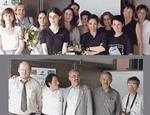
Laude from the student
|
In the event organised by the Ziti publishing house in Athens, December 1, 2009, on the occasion of the 30 years of E. Livieratos professorship (1979-2009) the Class-1983 student Alexandra Koussoulakou spoke about her teacher: |
 |
|
Society
In June 2012 he was appointed Minister of Environment, Energy and Climate Change in the Government of the Hellenic Republic (extraparliamentary member) serving until June 2013.
")
Addressing the Greek Parliament
From 1994 to 1997 he served as the first President of the Board of Governors of the re-organised component of the Hellenic Radiotelevision broadcasting from Thessaloniki.