Maps+Politics
Here, the heading "Maps+Politics" concerns mostly the use and/or misuse of maps as tools in political international affairs. As International Politics and International Relations (IR) [w] are affected by geospatial implications strongly related to history, the historical maps are also playing important role in the whole geopolitical setting. The cartography of Geopolitics and its historical backgrounds is thus entering into the picture. It is not at all accidental that in the Wikipedia lemma Geopolitics [W] the first image on the top of the page stands Ortelius' 16th cent. World Map Typus Orbis Terrarum with the link to History of Cartography lemma [w]. The special category of cartography, which formulates the context of Maps+Politics, is related to the geopolitical affairs and arrangements, the geospatial IR including international legality, the geo-balance of power, the conflicts, irredentisms, "vital-spaces", ethnographics, geopolitical designs and embodiments etc, all referred to the geospatial domain and its visualisation
The approach
This approach here, is not dealing with geopolitics, geostrategies, geopolitical theories/schools of thought (older and/or modern) and affined issues reflecting mainly ideology-based backgrounds in the global sense. It is only concentrated, in regional scale, on the role of maps as the natural medium for the depiction of all the geospatially referenced political interactions in IR. It is an obvious expectation to focus here on the historically turbulent region of Southeast Europe, the Balkans and the adjoined areas, which historically suffered and are still suffering the misuse of maps as political tools in IR. Living in one of the historically most unstable regions of Europe, it is natural to find strong cartographic interests and scientific challenges in understanding the use and misuse of maps in international bilateral politics and IR, especially between neighbouring states and to enrich the cartographic heritage research on this issue
Origins
The ancient origins of the involvement of maps in politics is referred back, in the late 6th cent., to the story of the Milesians asking military support from the Spartans who from their side, as Cicero says, offered earlier to Anaximandre a piece of land on Mount Taygetus for establishing there an Observatory
According to Herodotus, it was in 504 BCE when the archon of Miletus Aristagoras [w] visited Sparta, before the start of the Ionian Revolt [w] to convince the controversial king Cleomenes [w] and his Spartans for a military campaign against the Persians showing him an Anaximandros - Ecataeos type of map. The scaled distances shown on the map meant nothing to the Spartans who declined the Milesian request after hearing the long time needed to reach the enemy territories. This story of the late 6th cent. BCE is giving the first example of the use of maps in geopolitics and geostrategy and the reason why sometimes Aristagoras is considered as a cartographer (a map user) himself
Categories
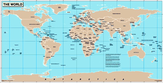
The elementary model of the map+politics case is the so called political map model well known from our school experience. It is the map depicting the setting of the countries of the World defined in size and shape by their state borders according to international conventions
 |
 |
But the traditional political maps apart, the categories and/or examples of maps related to international politics and IR are innumerous. It is almost impossible to develop a complete or standard list of maps of this typology. Besides, we have the cases of maps constructed either on purpose to serve geopolitical issues or maps created for general of other uses but implemented occasionally in serving geopolitical tasks and affairs. This diversity is by itself a multiplier which makes innumerus the maps which can be considered and listed as maps relevant or affine to geopolitics and IR. On the other hand we have the typology of explicit geopolitical map (or of the geopolitical map per se) with a current definition as: ...a map that shows the study of the relationship among politics and geography, demography, and economics, especially with respect to the foreign policy of a nation... Technically, in cartographic terms, a geopolitical map belongs to the huge family of thematic maps regulated scientifically by all methodologies and practices of Thematic Cartography. But they can also belong to other families of maps as are e.g. the general/reference maps, (among them are the topographic maps, the military maps etc.) as well as to a combination of map-types. In many cases the historical maps (i.e. maps belonging to the domain of the History of Cartography) are used in the map+politics discussion together with the special class of thematic maps, the ethnographic maps, first appeared in the 1840s dominating then the IR issues for almost a century, especially in Central and South-East Europe
Education
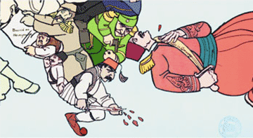
Yves Lacoste [w(fr)] in his La Légende de la Terre, Flammarion 1996, gives a key example on the maps+politics issue as it is implemented in education, even in its primary level. The example comes from the far 19th cent. but it is very significant on the political weight the maps could have in the early formation of people's geospatial conception in the context of politics. Lacoste's comment, which is associated with the relevant Carl Hertel's painting, is important for the understanding of the issue

Lacoste comments in the caption of the Hertel's famous painting: ...how dispelled are the schoolchildren during the geography lessons! The Prussian government foresaw the behavior of the future generations of schoolchildren when, in 1820, decided to teach History and Geography in the primary school, something which was previously reserved for princes, senior officials and high rank civil servants. This education should prepare future citizens fighting for the unity of the then fragmented Germany. The example was soon followed by all the German states, and in 1875 by France, worried about its cohesion after the defeat of 1871. But if the interest of the schoolchildren and the public was awoke for History, it was not the same for Geography, the geopolitical issues of which were negleted by academics enthousiasts of climatology and geology... - apparently the last comment refers to the French academics of that time and not to their German or British colleagues like, e.g. Friedrich Ratzel [w] [w(de)] [w(fr)] or Halford John Mackinder [w] or to non-academics like e.g. the American Alfred Thayer Mahan [w]
Thematics+complexity
According to current/common literature (see e.g., Evans and Newnham The Penguin Dictionary of International Relations, London 1988) some of the typical variables which parametrise geographically the geopolitical issues are the physical location, the geometry (shape - size), the climate conditions, the topography of the terrain (and the land coverege), the demographic composition, the natural resources (with water and energy on top), and the technological advances of a state, of a territorial entity, of a regional unity or complex involved in geopolitical disputes and IR difficulties usually with neighbouring counterparts. In the above variables it is worth, of course, to add in the overall consideration the general wealth, the military capacity, the historical and broader eduational and cultural parametres. Under this setting, even maps representing only a single theme of those listed above, can be associated and correlated with other relevant maps representing single or synthetic themes, for partial or complementary geopolitical accounts concerning an area with IR difficulties. In this context single maps can be collected into the geopolitical-analysis folder representing themes, which parametrise the above geopolitical issues, even if these maps are not necessarily constructed a-priori for geopolitical implementation
More types
More other types of maps considered as having geopolitical and IR inference of any type are, e.g.:
- maps that are interpreted as playing an indirect role in geopolitical affairs and IR, even in the cultural sense as it is, e.g., the case of the celebrated Matteo Ricci's World Map (1602) which is considered as a IR map-link in the Europe - Italy - Vatican relations with China
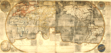 |
The 1602 Matteo Ricci World Map copy at the Österreichische Nationalbibliothek (ÖNB), Vienna |
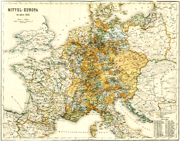
- the ethnographic / cultural cartographic typology in circulation from the mid 19th cent. to the WW II are easily considered as politically oriented representation
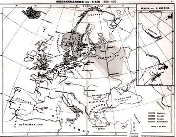 |
A 1897 Swedish map representing the spatial distribution of populations of Scandinavian and Norman origin in Europe from 9th to 12 cent. |
|
A 1877 German map representing the geospatial definition of Mittel-Europa in mid 13th cent. with relation to ethnic populations |
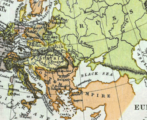
- The relevant maps related to the Eastern Question and its Macedonian byproducts are members of this category
- the satirical maps of the late 19th to early 20th cent. is a flourishing typology at that period
 |
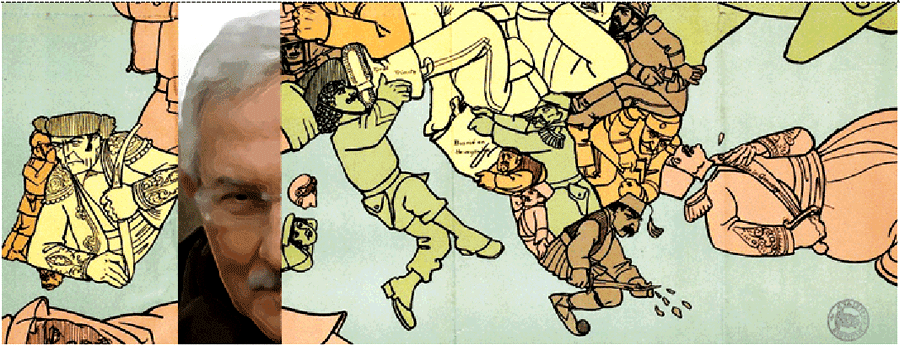
A detail of the Luis Roemaekers satirical map of 1915 The Mad-house - old song in new rythm commenting on the situation in the Balkan Peninslula which was just came out the Balkan Wars (1912-1913) Coroured by EL |
- the maps constructed for, associated with or used to political propaganda of any type
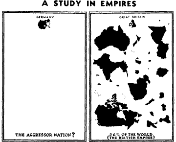 |
A typical propaganda conceptual map under the title "A study of the Empires", published in 1940 in the weekly newsletter Facts in Review, published by the New York German agency of information with a circulation of 70,000 readers. The concern of the weekly was to keep the US off the WW II |
- the historical well-known maps of the vital or living space / lebensraum flourished as proper typology in the period between the WW I and WW II
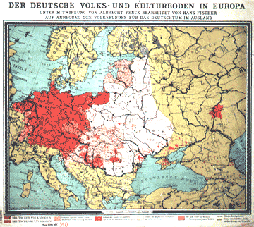 |
A 1925 German map of the vital-space (lebensraum) type representing, according to the title, the German People and Cultural territories (i.e. related to the German Culture) |
- the post WW II maps associated to the Cold War period
More maps of political type can be listed to rerpesent general of specific types with ad-hoc nominal definition like the following:
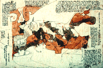 |
A 14th cent. political map of religius origin. The Opicinus de Canistris cartographic metaphora |
|
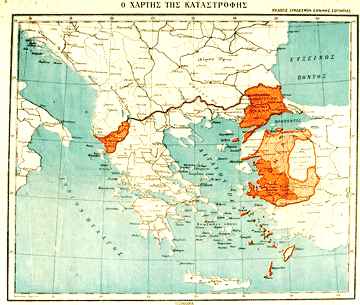
A Greek map published after 1922 under the title The Map of the Catastrophe. Explicitly political, the map refers to the internal political conflict on the responsibilities concerning the Greek defeat in Asia Minor, the massive withdrawn of populations which followed and the consequent territorial losses for Greece |
|
A French satirical map of the so-called De Gaulle type, popular during the implementation of the President's World policy |
|
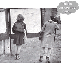
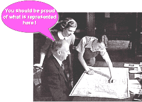
| Losers and winners: schoolchildren and maps in the post-WW II The callouts by EL |