


Books
The list in this category covers a 39 years period, from 1974 to present-day: the last 5 books published in the last five years, 2008-2013; the previous 14 volumes, 1985-2008; the 5 proceedings of seminars, workshops, meetings, 1978-2005; the 2 school atlases, 1994-1995; the 7 text-books, 1981-1993; the 5 lecture notes, 1974-1980. The index (el) stands for Greek language
The last 5
E. Livieratos 2013, European Cartography & Politics: the case of Macedonia (el) with a contribution by C. Paliadeli, Thessaloniki: Ziti Publications, p 144, 270x270, ISBN 978-960-456-372-2
Contact: sales<at>ziti.gr; info | sampleE. Livieratos 2012, European Cartography & Politics: the case of Macedonia, with a contribution by C. Paliadeli, Thessaloniki: Ziti Publications, p 144, 270x270, ISBN 978-960-456-372-2; Contact: sales<at>ziti.gr; info | sample
E. Livieratos 2010, Cyprus on Historical Maps. Placement, shape and rotation from a digital point of view, Cyprus Cartography Lectures, No.8, Nicosia: The Bank of Cyprus Cultural Foundation, p. 53, 220x300, ISBN 978-9963-42-892-2; info
E. Livieratos 2009, Cartographic Adventures of Greece, 1821-1919 (el) Athens: MIET-ELIA, Publications Dept., mietekd<at>otenet.gr , p. 287, 240x300 mm, ISBN 978-960-201-194-2
Contact: miet2<at>otenet.grE. Livieratos 2008, 25 Centuries of Cartography and Maps. A tour from the Iones to Ptolemy and Riga (el) Thessaloniki: Ziti Publishers, p. 263, 210x281 mm, ISBN 978-960-456-076-9. It is the second revised edition of the 1998 book with almost the same title. Contact: sales<at>ziti.gr; info | sample
Previous
E. Livieratos 2008, Holy Mountain and Cyprus in the Anthimos Gazis Map of Greece, 1800 (el) H.M. Simon Petra: Agioreitiki Library
E. Livieratos 2007, A Trip in the Dominance of Maps. Stories about therepresentation of the widening of the World (el) in the series Travels with Maps in Places and Utopias; Thessaloniki: Ziti Editions. Contact: sales<at>ziti.gr; info | sample | available also in e-book
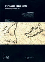
E. Livieratos, I. Beriatos (Editors) 2004, L'Eptaneso nelle carte. Da Tolomeo ai satelliti, the Italian version of the Greek book, Padua: Il Poligrafo; Universita IUAV di Venezia
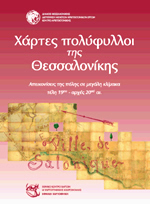
E. Livieratos (Editor) 2004, Multi-sheet Maps of Thessaloniki. Large scale City Representations, late 19th - early 20th Century (el) Thessaloniki: National Centre for Maps and Cartographic Heritage; Municipality of Thessaloniki
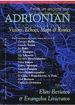
E.Livieratos, I. Beriatos (Editors) 2004, Adrionian extrema - proxima. From an Ancient Sea to a Modern Network: Visions, echos, maps and routes, Thessaloniki: National Centre for Maps and Cartographic Heritage; Aristotle University of Thessaloniki; Cephalonia-Ithaca Foundation.
E. Livieratos (Editor) 2004, A self-learned Cartographer: Sotiris Zisis 1902-1989 (el) Thessaloniki: National Centre for Maps and Cartographic Heritage
E. Livieratos (Editor) 2003, Map-sheets of North Greece. The first representation, late 19th - early 20th Centuty (el)Thessaloniki: National Centre for Maps and Cartographic Heritage; Athens: ELIA
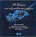
E. Livieratos (Editor) 2003, Cyprus in the Azimouths of Wind. Orientation in the cartographic Representations of European Cartographers of Cyprous, 14th - 19th Century (el) Thessaloniki: National Centre for Maps and Cartographic Heritage; Nicosia: Bank of Cyprus Cultural Foundation; info
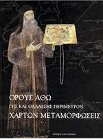
E. Livieratos (Editor) 2002, H. Mount Athos' Land and Sea Perimetre. Metamorphoses on Maps (el) Thessaloniki: National Centre for Maps and Cartographic Heritage
E. Livieratos (Editor) 2001, Germans Mapping Greece (el) Thessaloniki: National Centre for Maps and Cartographic Heritage.
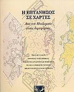
E.Livieratos, I. Beriatos (Editors) 2001, Eptanesos in the Maps. From Ptolemy to Satellites (el) Thessaloniki: National Centre for Maps and Cartographic Heritage
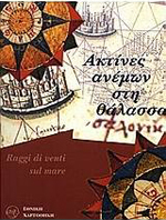
E. Livieratos (Editor) 1999, Rays of Winds at the Sea (Portolan maps) Thessaloniki: National Centre for Maps and Cartographic Heritage.
E. Livieratos 1998, A tour into Cartography and Maps: 25 Centuries from Iones to Ptolemy and Rigas (el)Thessaloniki: National Centre for Maps and Cartographic Heritage. Out of print
E. Livieratos 1985 (Editor), Thessaloniki in Maps, On the occasion for the 2300 years of Thessaloniki (el) Thessaloniki: Association of Rural and Surveying Engineers of North Greece. Out of print
Proceedings
E. Livieratos (Editor) 2005, Digital Approaches to Cartographic Heritage, 1st International Workshop of the ICA Commission Digital Technologies in Cartographic Heritage, Thessaloniki: National Centre for Maps and Cartographic Heritage. Out of print
E. Livieratos (Editor) 1998, 200 Years of Rigas Charta 1797-1997 (el) Scientific Conference at Kozani, Thessaloniki: Paratiritis Editions. Out of print
K. Katsambalos, E. Livieratos (Editors) 1985, Differential Geometry of the Gravity Field, IAG-SSG 4.56 Workshop, Chania, Crete, Thessaloniki: AUTH-SRSE Dept. Geod. & Surv., p 64. Out of print
E. Grafarend, E Livieratos (Editors) 1978, The Mathematical Structure of the Gravity Field, IAG-SSG 4.45 Workshop, Lagonissi, Athens: Higher Geod. & Cart. Lab., NTUA-SRSE, p 112. Out of print
G. Veis, E. Livieratos (Editors) 1978, The Use of Artificial Satellites in Geodesy and Geodynamics, 2, IAG-COSPAR Symposium, Lagonissi, Athens: NTUA, p 657
School Atlases
E. Livieratos, C. Boutoura, M. Myridis 1995, New School Atlas of Europe (el)Thessaloniki: Rekos Editions. Out of print
E. Livieratos, C. Boutoura, M. Myridis 1994, New School Atlas of Greece (el)Thessaloniki: Rekos Editions. Out of print
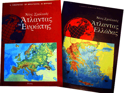 |
The School Atlas project, 1994; 1995. The first MDMP full-print products finilised at AUTH |
Text-books
E. Livieratos, A. Fotiou 1993, Ellispoidal Geodesy and Geodetic Networks (el)Text-Book, 2nd Revised Edition, Thessaloniki: Ziti Editions, p 440. Out of print
E. Livieratos 1989, General Cartography + Introduction to Thematic Cartography (el) Text-Book, Thessaloniki: Ziti Editions
E. Livieratos 1989, Theory of Geodesy (el)Text-Book, Thessaloniki: Ziti Editions, p 157
E. Livieratos, A. Fotiou 1986, Ellispoidal Geodesy and Geodetic Networks (el)Text-Book, Thessaloniki: Ziti Editions, p 404. Out of print
E. Livieratos 1985, General Cartography (el) Text-Book, Thessaloniki: Ziti Editions, p 180. Out of print
E. Livieratos 1982, Higher Geodesy Networks (el) Text-Book, Thessaloniki: Giapoulis-Giachoudis Editions, p 174. Out of print
E. Livieratos 1981, Ellipsoidal Higher Geodesy (el) Text-Book, Thessaloniki: Giapoulis-Giachoudis Editions, p 210. Out of print
Lecture Notes
E. Livieratos 1981, General Cartography (el) Lecture Notes (Xeroxed), Thessaloniki: AUTH-SRSE. Out of print
E. Livieratos 1980, Thematic Cartography(el) Lecture Notes (Xeroxed), 2nd Edition Thessaloniki: AUTH-SRSE. Out of print
E. Livieratos 1979, Mathematical Cartography (el) Lecture Notes (Xeroxed), Thessaloniki: AUTH-SRSE. Out of print
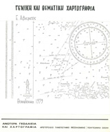
E. Livieratos 1979, General and Thematic Cartography (el) Lecture Notes (Xeroxed), Thessaloniki: AUTH-SRSE. Out of print
E. Livieratos 1978, Thematic Cartography(el) Lecture Notes (Xeroxed), Athens: NTUA-SRSE. Out of printE. Livieratos 1978, Physical Geodesy (el)Lecture Notes (Xeroxed), Athens: NTUA-SRSE. Out of print
G. Veis, E. Livieratos, H. Billiris 1974, Higher Geodesy I (el) Lecture Notes (Xeroxed), Athens: NTUA-SRSE. Out of print