


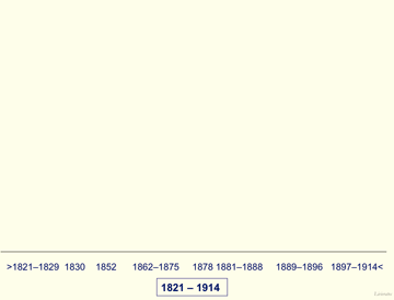
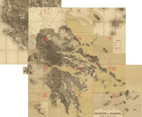
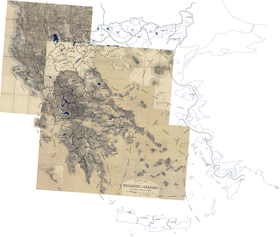
Mapping Greece in 19th Century
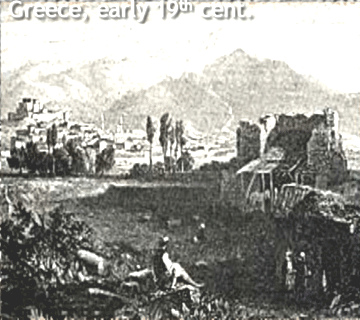 |
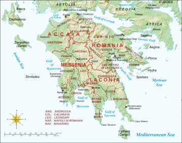
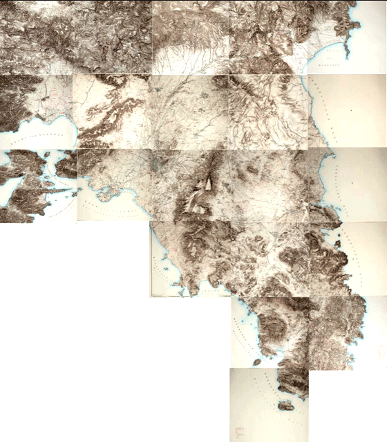
| Typical landscape of Greek mainlands in early 19th cent. Patras and surroundings |
The first systematic mapping work in the territory of Greece, after the Greek War of Independence in 1821, was carried out by the French military geographical-engineers in Peloponnese starting in 1828. The French mapping based on proper field-work concluded short before the mid 19th cent. In 1852 was published in Paris the 20 map-sheets of the kingdom of Greece in 1:200,000 scale compiled by the Dépôt de la Guerre, having before (1832) published the 1:200,000 scale map of the Peloponnese/Morée in 6 map-sheets. The second map of the young kingdom came half a century after, in 1883. It was the 1:300,000 map-series known as the "Kokkidis map", in 11 map-sheets, published in the famous Viennese k.u.k. Militärgeographische Institut, representing now the annexed territories of Thessaly according to the resolutions of the Berlin Congress in 1878. In the meantime between the 1850s and the 1880s an important mapping of the region of Attica was carried out in large map-scales by the Prussian military, in the frame of the German archaeological interests. Later on, systematic land surveys and mappings carried out by the Cartographic Service of the Greek Army, especially after 1897, following the relevant works started in 1881 by the Geodetic Detachment of the Greek Army, under the guidance of a small Austrian military mission (1881-1896) headed by Lt Col Heinrich Hartl
For the history of mapping Greece in 19th cent., see E. Livieratos 2009
Venetian head-start
The first systematic land surveys of territories which are under the sovereignty of the presend-day Greece started the late 17th cent. in Peloponnese/Morea during the Venetian rule 1685-1715; see about the Regno di Morea/Kingdom of the Morea the name given by the Serenissima in the possession of Peloponnese, even if not a proper kingdom [w] [w(it)] [w(it)]
 |
The land surveys carried out with great attention in the frame of the cadastral works by the skilled Venetian topographers. First order positioning measurements drived to the mapping of this historic land, which was subject of particular and strong interest of all occidental and oriental powers in the course of the centuries, after the Fall of the Byzantine Empire, in the mid-15th cent., to the first quarter of 19th cent.

The important Venetian general maps of Peloponnese (1707), based on land astro-topographic measurements, are not so well-known in the cartographic community and literature and in most cases it is improperly confused with the cadastre maps. The latter are constructed in the same period by the Venetians, apparently as a parallel but not intersected operation with the general mapping of Peloponnese
The analysis of two 1707 Venetian maps, called by Livieratos (2010) the Carmoy-Castelli-Borini map and the Ramena-Riviera map, precursors a century before, of the "semi-topographic" maps of Weiss, Lapie and Leake and of the "scientific" map of the French Expédition Scientifique, in the early 19th cent. is given by E. Livieratos 2010, "The Venetian maps of the Peloponnese Pianta Geografica del Regno di Morea and Del Regno di Morea 1707", to appear in a collective volume (el) edited by prof. Olga Katsiardi-Hering, Athens: MIET. For a version in English, see e-Perimetron Vol.9, No.1
The pre-1821 period
Among the West European naval powers with cartographic activities in the area, the French have a long and rich legacy in the representation of the Greek territories and seas long before the 19th cent., mainly due to the scholar/academic concern of important geographers, cartographers and travellers and of skilled hydrographers as well
 |
Baudrant 1716. A typical map of Greece in the early 18th cent. reproduced by other cartographers in the course of the century. Pierre Lapie 1826 Courtesy: Margarita Samourka |
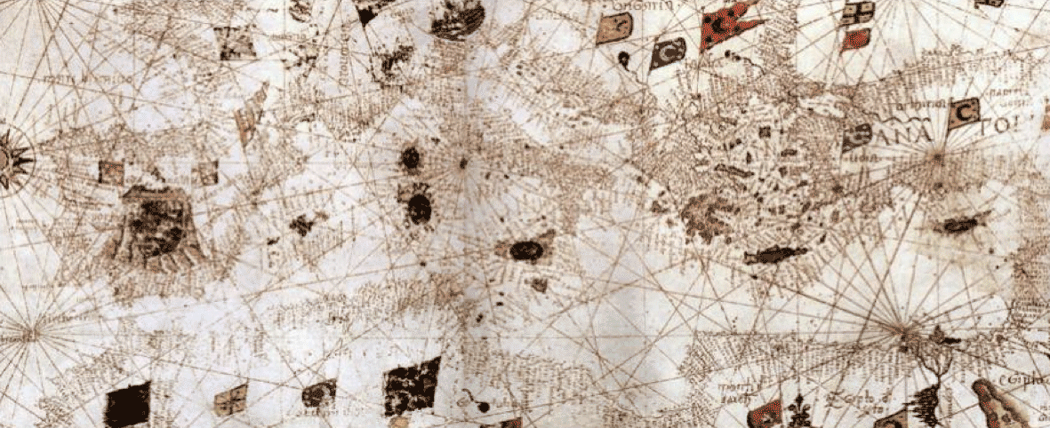
The latter are active in the Aegean and the Ionian Seas since the early period of the famous Capitulations, the mercantile facilitations given to the European naval powers in 16th cent. by the Sublime Porte (first to the French and later to the British and Dutch) and the 17th century French hydrographic activity for supremacy in the Seas as intensified in the Mediterranean
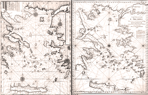 |
Two representative hydrographical French maps of the Aegean Sea from the mid and late 18th cent. recalling the portolan nautical map typology of the centuries before Courtesy: Margarita Samourka
|
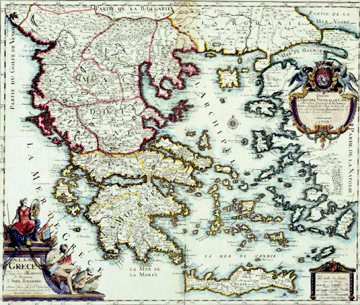
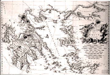
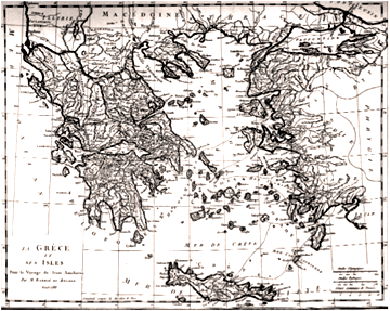
The Greek War of Independence, started in 1821, troubled the Concert of Europe's status-quo, set by the 1815 Congress of Vienna [w] From the late 18th and the early 19th cent. to the critical years, 1825-1827, decisive for the outcome of the Greek Case, when the War was in a deadly decline for the Greeks, but at the end with the fortunate way-out given in Navarino [w] a great number of personalities contributed in the documentation, representation and narration and of the Greek territory. Among these personalities are listed e.g. Choiseul-Gouffier [w] Barbié du Bocage [w]François Pouqueville [w] [w(fr)] Pierre Lapie (with his semi-topographical maps) together with Gaetan Palma the Austrian Franz von Weiss, the British William Martin Leake, a number of other travellers and last but not least the geographical-engineers of the French Expédition de Morée [w] [w(fr)] with their first scientific/geodetic mapping
 |
Choiseul-Gouffier map of "Modern Greece" Courtesy: Margarita Samourka |
|
Barbier du Bocage map of "Greece and her Isles" Courtesy: Margarita Samourka |
|
The bilingual (French-Greek) map of Gaetan Palma printed in Trieste in 1811. This map reflects the Napoleonic geopolotical plans for the area represented. Geographic information by the well known French traveller François Pouqueville are depicted on this map. It is interesting to notice the ad-hoc-type placement of Peloponnese (of Choiseul-Gouffier shape) in a separate frame |
|
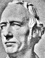
The British military William Martin Leake (the less known conveyor of the Parthenon marbles to Britain on Lord Elgin's account) was commissioned to survey the possible sites of invasion of Peloponnese by the Napoleonic French in the early 19th cent. Travelling in Peloponnese, as a military but also as an archaeology entousiast, he collected not only mapping data but also scholar notes for his maps and his travel books Courtesy: Hellenic National Research Foundation |
|
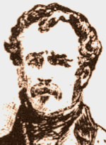
Franz von Weiss, a less known military cartographer made this major map in 1819-1821 with clearly military capacities, especially in describing the coastlines and the sea-shores. It is a less-known very important multi-sheet map of the region, of a typology followed also by the French (see the Lapie relevant maps of the area) at the same period Courtesy: Kriegsarchiv des Österreichischen Staatsarchivs |
|
The Pierre Lapie's 1822 multi-sheet map of South-East Europe, very similar to the Franz von Weiss map of the same period Courtesy: Sylvia Ioannou |
|
The Pierre Lapie's map of 1826, focused on Greece in uprising. It is the map that had in mind the first Governor of Greece Ioannis Kapodistrias when he wrote his letter to the French War Ministry asking cartographic support Courtesy: Sylvia Ioannou |
|
The 1829 Franz von Weiss version of his some years earlier map. It is the year that the French military started the mapping campaign in Peloponnese and the Foreign Minister of the Austrian Empire Klemens von Metternich had some new (apparently rather positive, but hardly feasible) ideas on the Greek Case Courtesy: Charalambos Papastathis |
|
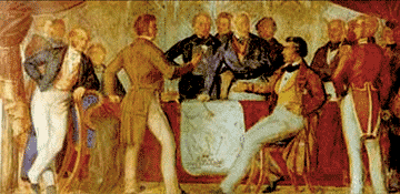
Conference of London 1830 for the Greek Case and the signing of the Treaty of London for Greek Independence. A discussion by the map of Greece, according to Thomas Guggenberger, the Bavarian artist's wall painting in the Hellenic Parliament |
|
The first borderline of 1832 on a two map-sheets published in 1834 (London-Argos). The field work was carried out by French, British and Russian military surveyors |
French mapping
The French mapping of Greece is strongly related with the early steps of the new Greek state started tentatively with the efforts of the first appointed Governor Ioannis Kapodistrias [w] in office from early 1828, and established in 1832 after his assassination and the appointment of the Bavarian prince Otto [w] as the first king of Greece, under the relevant London Convention, 1830. Kapodistrias' very first concern was the mapping of the new state, a precondition for the function of any modern state. He requests the French assistance on the issue since 1827!
|
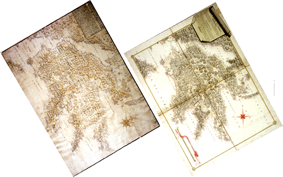
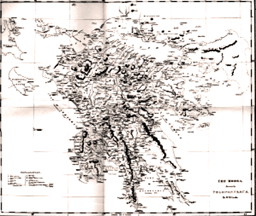
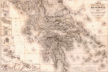
| The 6 map-sheets (plus two more sheets depicting some isles of the Cyclades) of the Peloponnese mapping project in the context of the Expédition Scientifique. It is the first scientifically/geodetically constructed map of the Greek territory. Courtesy: ELIA |
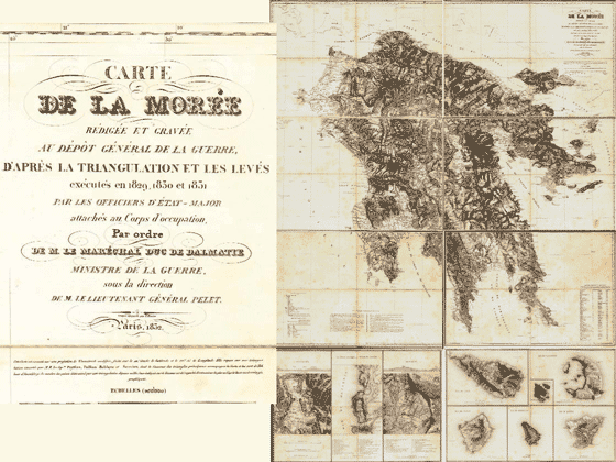
Of particular importance are the two phases of the French mapping in the context of the Expédition de Morée: the 1828-1832 first phase, resulting the six-sheet-map of Peloponnese and the second phase concluded in 1852 with the twenty-sheet-map of Greece
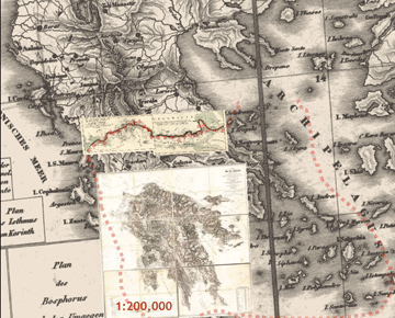 |
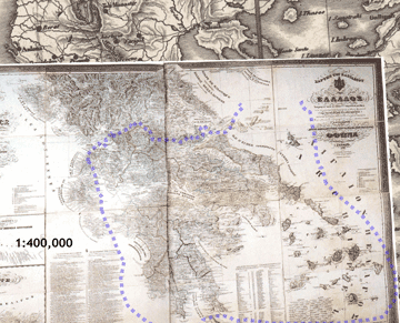
The 1832 map of Peloponnese in 1:200,000 scale, made under Peytier in the context of the mapping activities (1828-1831) of the Expédition and the map of the first borderline, published in 1834, following the Convention of London in 1830. Both maps are fitted here on the Franz von Weiss key-map of his general 1:400,00 map published in 1829 |
|
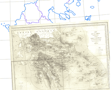
The 1852 map of Peloponnese in 1:200,000 scale, constructed in 20 map-sheets from the French military land surveys starting in 1828 to almost the mid 19th cent. |
Both maps in 1:200,000 scale are printed in Paris under the direction of the Dépôt de la Guerre, the French military mapping service [w(fr)] representing the lands of the new state up to the first borderline, as was defined in London in 1830 and mapped on the two-sheet relevant map by French, British and Russian military surveyors
From the birth of state to 1870s
The birth of the new Greek state in 1832 with its finally defined territory (after eleven years of a cruel struggle and the unfortune short rule of Kapodistrias) meets with a completed 1:200,000 new mapping of Peloponnese, by the French military, not yet available to the Greeks. Later, just a hundred copies of this six-sheet map will be sent from Paris to the Greek administration. In 1834, the Greek statesman Ioannis Kolettis [w] [w(fr)] [w(el)] a Carbonari-inspired and the leader of an informal pro-French early political party [w] [w(fr)] founded, with the support of the French educated jurist Georg Ludwig von Maurer [w] [w(de)] member of the Bavarian Regency to the still minor king Otto [w] the "Bureau of Economy" an innovative administrative entity for the mapping, the cadastre, the statistics, the exploitation of resourses and the infrastructural setting-up of the young state
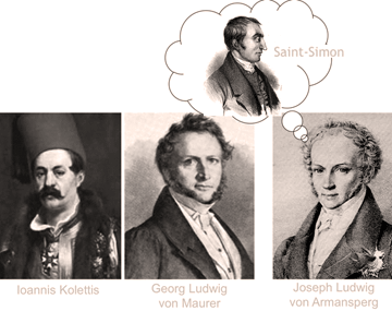 |
The plan for the estabishment, in 1834, of an innovative mapping, cadastre and land planning - management agency, the "Bureau of Economy", supported by Kolettis and von Maurer, was cancelled by von Armansperg, the head of the Bavarian Regency, based on accusations against the Bureau's staffing presumably influenced by Saint-Simon's socio-economic ideas |
The Kolettis-Maurer plan for a state modernisation in land management failed nascent due to ideological contrasts with the hard-line policy followed by the Regency head Joseph Ludwig von Armansperg [w] [w(de)] who opposed the project. The innovative "Bureau" was stopped under accusations for "Saint-Simonianism" [w] [w(fr)] Maurer went back to his university Law Chair in Munich and Kolettis was sent in diplomatic exile to Paris, where he is still keen to support (again in vain) the cartographic culture of Greece. The second attempt for introducing proper mapping and cadastre in the country was also a failure, after the unfortune Kapodistrias relevant plans in 1828. Instead, the 1836 decree for a land registry system, excluding the still unmapped public property (the national lands) was never implemented. The main cartographic product of the 1830s, after the 1832 French Dépôt-map of Peloponnese, is the 1838 bilingual (Greek-French) map of Greece in 1:400,000 scale, by the German military engineer and traveller Ferdinand Aldenhoven, derived from the cartographic works of Leake, Lapie, Weiss (presumably) and the French Dépôt topographers
 |
The 1838 Aldenhoven bilingual (Greek - French) map of Greece, dedicated to king Otto. A 1:400,000 large format map derived from the maps by Lapie, Leake and the Dépôt officers, as explicitly stated and by Weiss as it is implicitly indicated. Courtesy: ELIA |
The map is dedicated to king Otto and to his dream to expand the initial territory of his kingdom (e.g. Crete, Thessaly and the Ionian Isles are also depicted on this map)
After almost ten years of absolut monarchy, a revolt in 1843 forced Otto to obey the rules of a constitutional monarchy. Kolettis came back from Paris assuming the duty of the first constitutional prime-minister, in 1844 to his death in 1847. This was the period of building up the major Greek national ideology of the second half of 19th century up to the first two decades of 20th century, the well-known Great Idea (Megali Idea) [w(fr)] developed in a clear and imposing geographic context fueled by the growing ethographic ideas and the relevant mappings, especially in Central and South-East Europe
|
In 1852 the French 1:200,000 map of Greece in twenty map-sheets was published in Paris concluding the Dépôt land surveys started in 1828 and continued after 1832, the German geographer Heinrich Kiepert published his 1853 map and Kolettis' close associate Konstantinos Paparrigopoulos [w] [w(de)] a major national historian, with geographical and cartographic interests, published his monumental historical work in the period from 1860 to 1875. Paparrigopoulos and the relevant Society for the Dissemination of Greek Letters established in 1869, affected the Greek side in the cartographic-ethnographic hard disputes in the Balkans the years to come in the context of the Eastern Question [w] and in the 1878 Congress of Berlin [w]
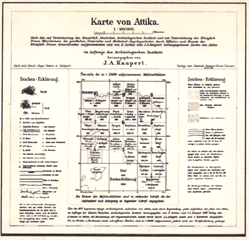 |
The legend of the Map of Attica by Johann August Kaupert with the sheet division in the key-map in the 1:100,000 format and the four partial map-sheets in the 1:25,000 format |
In this period Prussian military surveyors under Johann August Kaupert [w] worked in large scale mapping mainly in Attica (1862-1868 and 1875-1884) for the Karten von Attika project, published in Atlas-form in Berlin, 1900 Kaupert is the leading personality in the mapping project associated to the archaeologist Ernst Curtius [w] [w(de)]. This was in the context of the activities in Greece of the German Archaeological Institute of Athens founded in 1874, the second after the relevant École française d’Athènes established in 1846
A hectic decade, 1870-1880
The decade 1870-1880 is a hectic period in the Balkans reflected in the cruel regional bi-lateral and multi-lateral geopolitical conflicts involving also the Great Powers in complicated antagonisms. The political disputes concerning mainly the succession of the Ottoman Empire in its European territories and the, so-called, Macedonian issue, in its late 19th - early 20th cent. version, are blended with mutually contested notorious ethnographic mappings. This is a real "battle of maps" between the major nations of the area preparing the grounds for real but still undeclared battles in the early 20th century in territories still under the Ottoman rule
A number of militant cartographers, from all sides, involved in the Eastern Question, are active in the last quarter of 19th and the first decade of 20th cent. before the final regional setting of 1913, after the two Balkan Wars (1912-1913) [w] and of 1918, after the WW I
Constructive tend and failure, 1881-1897
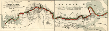
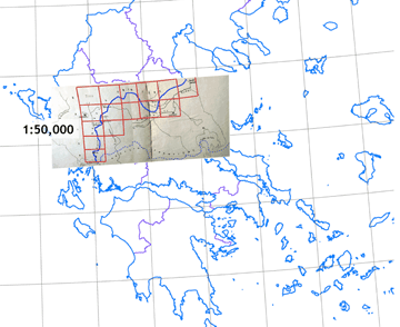
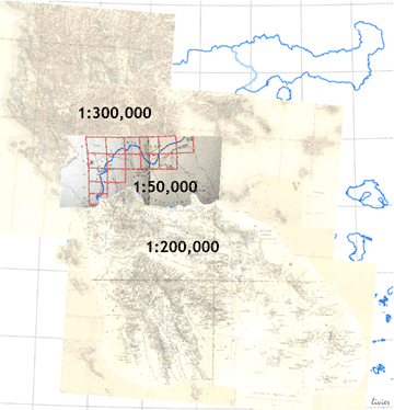
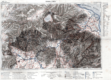
The Congress of Berlin in 1878, resulted the annexation of Thessaly into Greece and the split of Bulgaria in two territorial entities. The delimitation/demarkation of the borderlines in both cases was headed by a British military engineer the Maj Gen John Charles Ardagh. This was the second borderline of Greece in 19th cent. (1881), half a century after the first of 1832. The Ardagh demarkation was based on a proper 1:50,000 mapping of the borderline zone in 15 map-sheets
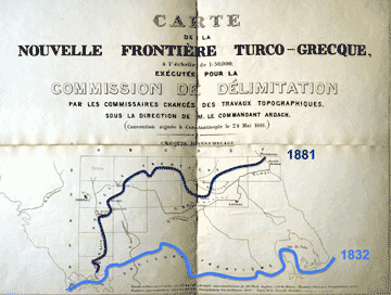 |
The key-map of the fifteen map-sheet layout of the Ardagh borderline mapping following the Congress of Berlin resolutions and the following Greek-Ottoman negotiations on the issue. The first (1832) and the second (1881) borderlines of Grecce are fitted in overlay |
|
The 1:50,000 map-sheets setting for the map-referenced documentation of the 1881 borderline, according to the Ardagh delimitation and the relevant international agreement |
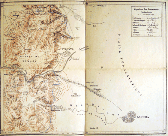 |
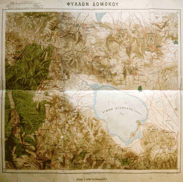
| A 1:50,000 map-sheet (Larissa-Tyrnavo) of the Ardagh-setting for the demarkation of the 1881 borderline according to the Congress of Berlin resolutions (1878), the Greek-Ottoman negotiations which followed and the Commissioners' final agreement in Constantinople (November 1881) signed by the representatives of Germany, Austria-Hungary, France, Great Britain (J.C. Ardagh), Greece (G.A. Metaxas), Italy, Russia, Turkey Courtesy: ELIA |
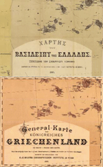
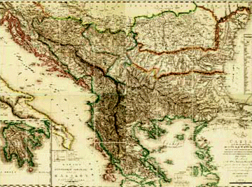
In 1884 a new map of the kingdom of Greece was prepared now with the annexed Thessaly, under the assistance of the Austrian military cartographic agency, the famous k.u.k. MGI - Militärgeographische Institut of Vienna [w] known also as the "Ifikratis Kokkidis map" in eleven 1:300,000 map-sheets. This map printed in Vienna, in two versions (in Greek and in German), is a typical derived map, based on the well-known 1:300,000 von Scheda cartographic typology, enhanced for the southern part of the country by the adaptation of the French 1:200,000 map-sheets, the result of the 1828-1852 Dépôt mapping
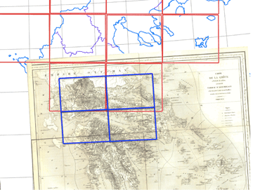 |
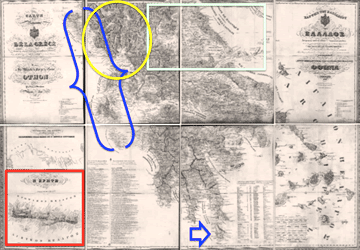
The von Scheda type of map-sheet division (red) in 1:300,000 vs the 1852 Dépôt map-sheet division (blue) in 1:200,000 in the same fitting. Here the setting concerns the period of the first borderline of Greece (1832-1881) i.e. the ante-1881 demarkation of the new borderline according to the Congress of Berlin resolutions (1878) and the Constantinople agreement (1881) |
|
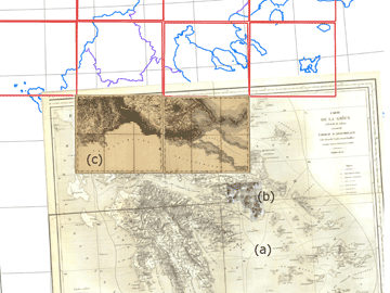
The von Scheda type of map-sheet division (red) in 1:300,000 with the two sheets (c) representing the north side (Ottoman Empire) and the south side (Greece) of the first borderline (1832). The setting is fitted on the 1852 Dépôt map (a) adding the also fitted Prussian mapping mosaic of Attica (b) |
The annexation of Thessaly was the starting-point for a cartographically constructive period in Greece related also to advances in university engineering education and relevant reforms in the state administration. The period under the important statesman Charilaos Trikoupis [w] who dominated the political life of the country in the 1880s to the mid 1890s, is a constructive phase in processing the concepts and establishing the still missing institutional mapping and cadastre services and practice, after the more than half a century life of the new Greek state. The 1:50,000 entirely Greek land mapping in Thessaly under the infantry officer Alexandros Mavrokordatos with his Greek surveying group (1887-1889), is a remarkable example, even if quantitatively small, of this new phase of the country's cartographic history of 19th cent. Mavrokordatos got a mapping training assisting the Prussian military surveyors of the Karte von Attika project
 |
A 1:50,000 map-sheet of the Alexandros Mavrokordatos mapping campaign in Thessaly (1887-1889). Courtesy: ELIA |
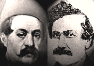
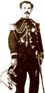
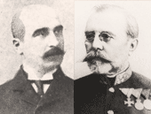
The worth mentioning contribution by the mapping and cadastre expert Konstantinos Karousos (a nobleman born in Trieste, thus close to the influential pro-Austrian Greek historical community of this important port-city, for years the mercantile haven of the Austrians) and his efforts to convince Trikoupis on the need of a strong civil service dedicated to cadastre and mapping was soon collided with the reaction of the military engineering establishment which opposed the creation of a civil mapping service. Trikoupis in 1889, after the Karousos initiatives, invited a three-member Austrian military mapping mission headed by the geodesist Lt Col Heinrich Hartl. It is interesting to notice that the invitation was addressed for the organisation and implementation of the cadastre. The Austrian officers wearing their military uniforms stayed in Greece until 1896, organising the first systematic cartographic and cadastre operations in the context of a military mapping service. First, as the Geodetic Mission, together with three young Greek officers, from the Corps of Engineers (Evlambios Messalas, Konstantinos Nider and Konstantinos Konstantinopoulos) selected to join the Austrians. Soon the Mission was renamed in Geodetic Detachment (1891) and later in Cartographic Service of the Army (1895) taking the final name Geographic Service of the Army in 1926 under which this historical military mapping agency is operational so far. The period from 1889 to 1897 was very tough for the mapping and cadastre work, under the Austrian guidence, suffering sometimes disappointment, controversy and critisism, mailny due to the strong turbulences in the political and economic life of the country at that time. Nevertheless, the men of the Geodetic Detachment did a pioneering work in mapping and cadastre, shaping a proper legacy and developing a spirit of excellence, professionalism and also an elite-behaviour in the tense social, political and cultural life of the period with strong national feelings fueled by the unstable geopolitics in the broader region of South-East Europe, suffering still the collateral effects of the endless Eastern Question but also of the domestic Great Idea born in the 1840s and growing strong since then as it was also the case in the northern neighbourhood of Greece and elsewhere in Europe
A new start, 1897-1912
The perfunctory war againts the Ottoman Empire in 1897 and the material and moral depression followed its fortunately short duration developed the basis for a serious re-setting of the military Cartographic Service, now under the well trained and experienced Greek command, still in close operational contacts with the Viennese Militärgeographische Institut which offered support until almost the mid-1910s
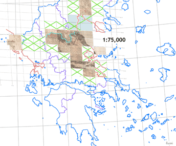 |
The post-1897 mapping plan of the Cartographic Service in 1:75,000 scale map-series following the standards of the Austrian Spezialkarte |
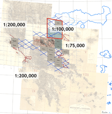 |
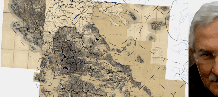
A summary of the map-series scales covering the territories of Greece from 1832 to 1913. The French Dépôt map-series in 1:200,000 (1832, 1852) covering the south part of the country, the 1:75,000 Spezialkarte-type map-series of the post-1897 mapping in the central part and the Generalkarte 1:200,000 Austrian map-series coverage of the north part. Eight map-sheets of the 1:75,000 series shape the 1:100,000 derived maps |
The period 1897 to 1912 is a bright period of the Cartographic Service in field work, map production and the consolidation of the esprit de corps of the military cartographers who will play an imposing historical role in the political, social and institutional affairs of Greece in the early 20th cent. especially after the military coup of 1909, known as the "Goudi Coup" [w] [w(fr)]
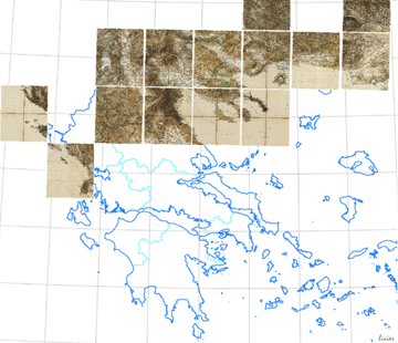 |
The 1:200,000 map-sheets of the Generalkarte gigantic project planned and implemented by the Viennese k.u.k. Militärgeographische Institut since the late 19th cent.
|
With the "Goudi Coup" the influence of the military in the institutional structure of the new political establishment of Greece was decisive. This took its extremes in the mapping and even in the cadastre state policies, where the military control was unquestioned and absolute, after the 1911 legislative reforms on the authority and the function of the Cartographic Service of the Army, whilst all other infrastructures in the field of public works passed in the domain of the civil public administration and of the private sector, a process which was smoothly started from the late 19th cent.
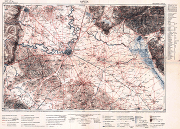 |
A typical map-sheet of the 1:75,000 Greek map-series in the post-1897 era of mapping activities in Greece, following the k.u.k. Militärgeographische Institut land measuring and mapmaking standards. The maps of this series were printed in Vienna. The map-sheet represents the plain area of the city of Larisa in the well surveyed region of Thessaly, annexed in 1881 |
|
A typical map-sheet as in the above image. Here, the map-sheet represents the mountain-area of the lower Mt Olympus and the narrow pass of Tempe in the borderline area of the period 1832-1881 |
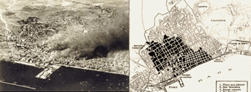
A noteworthy contribution of the civil service in the surveying/mapping, land planning and management, without any participation of the military Cartographic Service (at that time involved in the mapping of Macedonia) is the action-plan and implemetation for the urban redesign and planning of the city of Thessaloniki, after the great conflagration of 1917, known as the Great Fire [w] [w(fr)] which destroyed the second largest city of Greece, while the Allied Forces were already there to support the Macedonian/ Salonica Front [w] [w(fr)] of the WW I Balkans Campaign
|
The 1917 conflagration of Thessaloniki which destroyed the major part of the city. An exemplar topographical work contributed to the fast planning and reconstruction of the city |
|
The International Commission (Greek-French-British, called sometimes after the name of Ernest Hébrard) appointed to survey, plan and reconstruct the city of Thessaloniki after the 1917 conflagration, by the Minister Alexandros Papanastasiou, a known statesman served later as Prime minister for a short period, the founder of the Aristotle University of Thessaloniki. Member of the Commission was Dimitrios Lampadarios (in circle), professor of Geodesy at the Technical University of Athens |
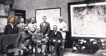 The International Commission for the new city-planning of Thessaloniki, after the Great Fire of 1917. Back, from left: Dimitrios Lampadarios, geodesist; Konstantinos Kitsikis, architect; Joseph Pleyber, civil engineer; Thomas Hayton Mawson, garden designer-landscape expert; Aristotelis Zachos, architect-town-planner. Front, from left: Ernest Hébrard, architect-town-planner; Alexandros Papapastasiou, minister; Angelos Ginis, civil engineer
![[W]](http://commons.wikimedia.org/wiki/File:Regno_di_Morea.svg)
The aftermath
The complete military control on the mapping and cadastre issues of Greece, sometimes reaching the levels of a sealed, highly classified "black-box" in the state affairs and in the functional relations between the state and the society concernind the lands (becoming worse after the post-WW II Greek Civil War 1944-1948 and the following Cold War) remained substantially unaltered for almost 65 years, to the last quarter of 20th cent. This had severe consequences in the state, regional and local administration, the economy, the land uses and abuses, the environmental planning, management and control and in the overall mapping culture of the country. Greece is still suffering and gasping to develop its mapping and cadastre infrastructures and the associated geospatially-related operational systems and functions for the benefit of the society and its growth, according to the relevant European and international advanced standards