
Lectures+Events
The lectures, mostly in Greek (el), aimed more at the general public, but also addressed to specialised audiences, especially in the frame of the scientific conferences. All public lectures are invited by prominent foundations of Greece interested in the topics of cartography and the legacy of maps. Special interest is demonstrated by the inviting institutions about the works and activities of the last years (from 2007 onwards) in the context of Cartographic Heritage:
2017
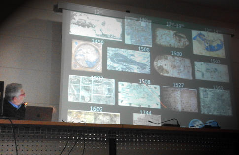
Ktima Gerovassiliou, Epanomi: The "magic" of representation: 10 maps that changed the World. Are maps magical images? Are they images of the truth or just a lie? Are they useful or useless? And why is that man, for 300 centuries B.C. to date, continuously draws maps, images of geographical location, in different ways and techniques? What has our civilization gained from maps, during the best and the worst years? Did the maps really change the World and the way we think of it? Did they bring humans closer or further apart? And why is it that while other countries based their progress on maps, we, Greeks, were not able to do so, from the first day we became a state to date, even though we were the first to talk about maps since the Ionian period. These are a few of the many questions that can be asked about maps and their role on a country’s and nation’s education, culture, economy, science and technology. The answers to these questions will or will not confirm the view of many that a country’s general cartographic education depicts the level of society’s development! The lecture and discussion will revolve then around all of the above, after the presentation of 10 selected spectacular maps that influenced, in one way or another, the change of the World’s image, in relation to the historic events that affected or were imposed on their construction. The maps cover almost 6 centuries till the 18th century, focusing on the 16th century that marks the radical change of the world’s old image, a world with three Continents, like humans and their civilization knew it, as a stereotype, for more than 2000 years. Gerovassiliou Wine Museum, Epanomi, Thessaloniki, 6 February 2017. More | Poster | Video | Photos | Greek
Municipality of Thessaloniki
Thessaloniki: Rare manuscript maps of the Archipelago 330 years before. Lecture about the rare manuscript maps of the Cyclades islands in the central Aegean Sea, made by the French in 1685-1687 following orders of Louis XIV, which revealed recentry in the Aristotle University of Thessaloniki (AUTH) Library as part of the Tricoglou Library donated to AUTH in 1963. These maps are subject of cartographic and historical research carried out in the AUTH CartoGeoLab in partnership with the AUTH Library. These exceptional maps are presented for the first time to the public, on 25 January 2017 at the Thessaloniki City Hall. More | Youtube | Video | Audio (all in greek)
2016
European Cultural Centre of Delphi
Delphi: E. Livieratos invited contribution "Satirical Maps: a cartography footnote between pop-art and ideology" in the exhibition and round table discussion on Satirical maps held in the European Cultural Centre of Delphi, 10 December 2016
History Department, Ionian University, Corfu
Corfu: E. Livieratos invited lecture "Maps and History - History with Maps" in the History Department, Ionian University, Corfu 6 December 2016
 Chang'an University, Xi'an
Xi'an: E. Livieratos invited lectures "International Challenge of Cartographic Heritage in the Era of the Digital" and "Reflections on the Coupling of the 'Belt and Road' Modern Mapping Issues with Relevant Cultural Challenges" in Chang'an University, 17-26 November 2016

Museum of Byzantine Culture, Thessaloniki
Thessaloniki: E. Livieratos invited contribution "The World Map by Anthimos Gazis, Vienna 1800". Lecture in the frame of the exhibition "Struggle against Time" at the Museum of Byzantine Culture, 13 January 2016, 19:30 - 20:30 | Youtube | Press 1, 2
2015
 Parnassos Literary Society, Athens
Athens: E. Livieratos, invited contribution "Between representational art and ideological influence" in the presentation of P. N. Soucacos book "Satirical Maps. Historical and Satirical Accounts of Europe (19th-20th century)", Athens: Miletos 2015 ISBN 978-960-464-690-6. Presented at the Parnassos Literary Society, 24 November 2015
Santa Verdiana, Florence
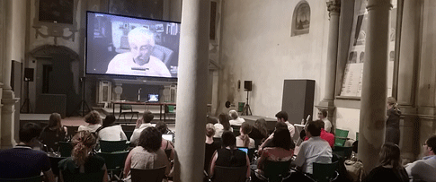
Florence: E. Livieratos, invited lecture/talk via Skype to Italian doctoral students in geomatics, participants of 2GG (2 Giorni di Geomatica/2 Days of Geomatics), 23 June 2015
 Geographic Sciences and Natural Resources Research / Chinese Academy of Sciences, Beijing
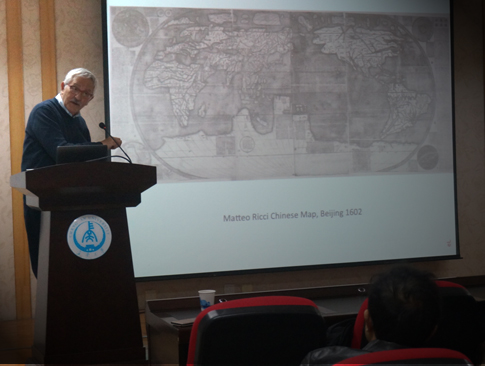
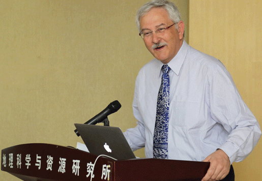
Beijing: E. Livieratos, invited lecture "Discussion on the relations of the Matteo Ricci Chinese World Map", Workshop on Ancient Chinese Maps and Exchange of Chinese-Western Cartographical Culture, 3 June 2015
 Ionian Academy, Corfu
Corfu: 10th Jubilee ICA Workshop on Digital Aproaches to Cartographic Heritage, 27-29 May 2015
 Aristotle University, Thessaloniki
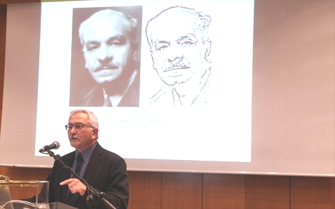
Thessaloniki: E. Livieratos, Laudatio, Prof. Ferjan Ormeling, Doctor Honoris Causa Ceremony, Aristotle University of Thessaloniki, Facutly of Engineering; 7 May 2015
Berlin: E. Livieratos, Digital analysis of the content of old maps, invited presentation in the Kolloquium "Geodäsie – Mathematik – Physik – Geophysik" der Leibniz-Sozietät aus Anlass des 75. Geburtstages von Prof. Dr.-Ing. habil. Dr. h.c. mult. Erik W. Grafarend, 13 February 2015 (presentation)
2014
Thessaloniki: E. Livieratos, "1912: The culmination of the 25-year "cartographic formation" of Greece. Signifieds, contexts and reflections". Official speech on the "26, 28 October" national anniversary ceremony at the Aristotle University, 26 October 2014
Patras: 13th Hellenic Cartographic Conference, 22-24 October 2014
Thessaloniki: E. Livieratos, "Some reflections on the paper-images of Holy Mt Athos", Municipal Gallery of Thessaloniki, 9 October
Budapest: 9th ICA Workshop on Digital Aproaches to Cartographic Heritage, 4-5 September
Groningen: Doctoral thesis defence by Jacky Benavides "Measuring of the Histrorical City", Information Science, Faculty of Arts, University of Groningen, 3 July
Thessaloniki: E. Livieratos, "Mirroring geography in maps: the historical cartographic seesaw of East Mediterranean and the Black Sea system"; invited lecture at the 8th South East Europe Energy Dialogue The New Energy Mix, Macedonia Palace Hotel, 11-12 June
Ljubljana: 19th Conference of the Groupe des Cartothécaires [programme]; the creation of the MAGIC Group, 22-24 May
Corfu: E. Livieratos, "The language of maps in the representation of Geospace and History". Lecture at the History Department, Ionian University (in Greek) info, 13 May
Thessaloniki: 11th International Book Fair: Meeting of the public with the author of the book European cartography and politics: the case of Macedonia (in Greek) Ziti Editions (info | sample), 10 May
Thessaloniki: Doctoral thesis defence by Maria Pazarli "Rigas Velestinlis Charta of Greece. A cartographic approach" (in Greek) School of Rural and Surveying Engineering, Faculty of Engineering, Aristotle University of Thessaloniki, 19 March
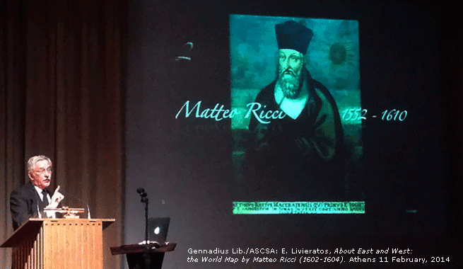 |
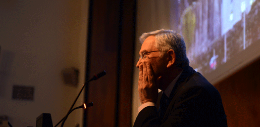
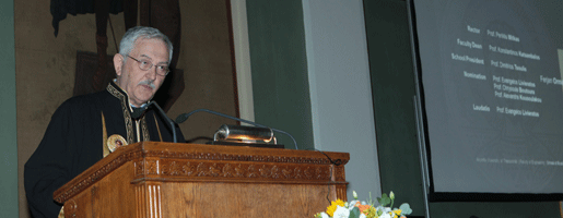
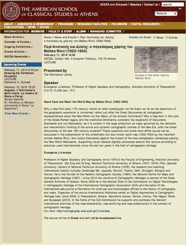
Athens: Lecture, E. Livieratos, About East and West: the World Map by Matteo Ricci (1602-1604), (el), invited by the ASCSA - Gennadius Library, Cotsen Hall, 11 February |
2013
Thessaloniki: Lecture, E. Livieratos, Macedonia on maps, invited by the Society for Macedonian Studies, 18 December; (el)>
Rome: 8th ICA Workshop on Digital Approaches to Cartographic Heritage, Italian Geographic Society, 19-20 September
Thessaloniki: E. Livieratos, Cartography of Arab Spring, invited contribution at the presentation of the collective issue edited by Elias Kouskouvelis, Laboratory of International Relations and European Integration, University of Macedonia; War Museum, 15 May
2012
Athens: Introductory speech On the prerequisites for spatial planning, at the scientific seminar Entrepreneurship and spatial planning: coexistance or rivarly? organised by the Scientific Society of the Law of City and Spatial Planning, 24 October; text (el)
Barcelona: 7th ICA Workshop on Digital Approaches to Cartographic Heritage, Cartographic Institute of Catalonia, 19-20 April
Thessaloniki: Lecture, E. Livieratos, Cartography and maps of the Balkan Wars, on the occasion of the map exhibition for the 100 years anniversary of the Liberation of Thessaloniki, War Museum, 7 September
Athens: Lecture, E. Livieratos, Thessaly as the main spatial interface in the cartography of national integration in the second-half of 19th century, at the scientific conference for the 130 Years from the Annexation of Thessaly in the Greek State 1881-2011, organised by the Historical and Ethnological Society of Greece, the Municipality of Volos with the cooperation of the General State Archives - Archives of Magnesia, Old Parliament Building, 5 February; (el) text (el)
Thessaloniki: Lecture, E. Livieratos, Revisiting Ptolemy's Geographia in the Digital Era passing through the Middle Ages and the Rennaisance, organised by the Art Society "Techni" at the Macedonian Museum of Contemporary Art, 10 January
2011
Athens: Lecture, E. Livieratos, Geography, in the Lecture Circle Science - Technology - Economy in Ancient Greece. Goulandris Natural History Museum, 12 December; (el) long abstract (el)
Volos: Lecture, E. Livieratos, Thessaly, the spatial interface in the cartography of national integration during the second half of 19th century, on the occasion of the 130 Years from the Annexation of Thessaly in the Greek State 1881-2011, Municipality of Volos, 10 December; (el)
Athens: The presentation of the book by Aikaterini Koumarianou, IANOS, 12 October; more (el); more (el)
Paris: Tutorial on 3D Digitization, at the BnF, 2 July
The Hague: 6th ICA Workshop on Digital Approaches to Cartographic Heritage, Netherlands National Archives, 7-8 April
2010
Athens: Lecture, E. Livieratos, The ancient Greek numerical geographical foundation of the representation of the enlarged renaissance World but also of the today Digital Earth, at the Athens City Museum, 29 November, Association of Ancient Greek Technology Studies
Thessaloniki: E. Livieratos, Thessaloniki, a city eternally depicted on maps and charts; Invited lecture at the official opening ceremony of the European Study Group for Dysphagia and Globus Annual Meeting, 24-26 September
Kozani: Kozani Municipal Map Library; a Series of Map Exhibitions: 11 October-16 January 2011, more (el)>; 27 May-26 September more (el); 20 March-23 May more (el); 17 January-14 March more (el)
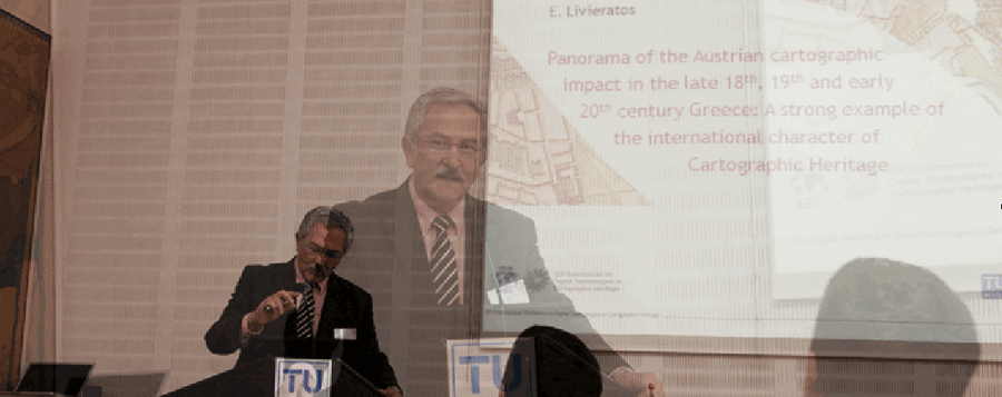
Vienna: 5th ICA Workshop on Digital Approaches to Cartographic Heritage, Technical University of Vienna, 22-24 February
2009
Athens: Mapping Cartography: 30 Years of cartographic contribution (1979-2009), organised by the publishig house ZHTH to honor E. Livieratos' 30 years of full-professorship at the Aristotle University of Thessaloniki, Bookstore IANOS, 1 December; more (el)
Athens: E. Livieratos, Key coastline depictions of the Morea from Ptolemy to early 19th century cartography: relating maps with geostrategy, Invited contribution, 2nd Workshop The Mediterranean and its seas: Natural, social, political environments and landscapes, 15th-20th centuries, Joint project, University of Athens with the University of Minnesota, 1-3 October; long abstract
Berne: E. Livieratos, invited participation in the celebration of the 50th Anniversary of the International Cartographic Association, 9-10 June; p.25
Venice: 4th ICA Workshop on Digital Approaches to Cartographic Heritage, University IUAV of Venice, 6-7 April
2008
Athens: E. Livieratos, Presentation of the new book by G. Tolias History of the cartography of the Hellenic space. Maps from the Margarita Samourka Map Collection, National Research Foundation, 20 November; presentation text (el)
Barcelona: 3rd Workshop ICA Commission on Digital Technologies in Cartographic Heritage, Cartographic Instutue of Catalonia, 26-27 June
Athens: E. Livieratos, Cartography of Cyprus, inaugural speech at the Exhibition Cultural publications on Cyprus 1984-2008, organised by the Bank of Cyprus Cultural Foundation at the House of Cyprus, 27 March - 4 April; full text (el)
2007
Thessaloniki: E. Livieratos, Cartographic representations of Holy Mount Athos from 15th to 19th cent., in Five centuries of pilgrimage in Mount Athos, 1405-1930, orgazosed by Agioritiki Estia, Municipal Library, 16 December
Thessaloniki: The AUTH Cartography Group participation in the project: Righas Charta in the Digital World, Tellogleion Centre for Arts, 11-16 November; more (el)
Nicosia: E. Livieratos, Cartography issues in Rigas Charta, invited contribution at the Symposium on Righas Charta, Bank of Cyprus Cultural Foundation, 27 October; info (el); full text (el)
Thessaloniki: Contribution to the cartographic exhibition Chios nella cartografia rinascimentale, Istituto Italiano di Cultura, Salonicco, 17 Ottobre; info (it)
Argostoli: E. Livieratos, Shapes and names of Cephalonia. Cartographic representations of 18th cent., invited contribution at the Conference, From the St George Castle to Argostoli (1757-2007) - The Venetian Rule in Cephalonia (1500-1797), 27-30 September, Municipality of Argostoli - Korgialenios Library, 29 September; info (el); text (el)
Moscow: The AUTH Cartography Group participation at ICC 2007, Moscow, 4-10 August; Programme
Ermoupolis: E. Livieratos, C. Boutoura, Insular cartographic representations from a numerical point of view, in Island Cartographies: Knowledge and Power, Ermoupolis, Syros, 16-17 July; Programme(the ready presentation in its ppt-form was not finally addressed, due to health impediment)
Berne: The AUTh Cartography Group participation at ICHC 2007, Bern, 8-14 July; more
Berne: E. Livieratos, Teaching digital analysis techniques for historical maps, invited contribution to the ICA Session on Teaching the History of Cartography, International Conference on History of Cartography, 7 July; more
Athens: 2nd ICA Workshop on Digital Approaches to Cartographic Heritage, National Research Foundation, 18-19 May
2007 - Righas Charta Year; the Cartouche of Righas Charta in a "Zoomify" image