


Maps
In the field of map production with preparatory origins at the mid-1980s in the frame of the work carried out in Thessaloniki, intense efforts invested in setting-up an activity in map-design and map-production. The whole issue was based on a text-book published in 1985 by E. Livieratos, General Cartography (el) Thessaloniki: Ziti Editions, p.180, with the second edition in 1989 as General Cartography+introduction to Thematic Cartography (el) Thessaloniki: Ziti Editions, p.216
 |
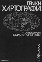 |
| The 1985 edition | The 1989 edition |
This book gave most of the necessary theoretical background and practical directives for the principles of work of a map-design and map-production unit in the mid-1990s by Prof Chrysoula Boutourawho developed a computer-assisted map-design+map-production (MDMP) chain at the SRSE-School of Rural and Surveying Engineering - AUTH Department of Cadastre, Photogrammetry and Cartography, and a proper teaching and research activity at graduate and post-graduate level as well
The first finalised product was the two School Atlases (Greece and Europe) prepared for Rekos Editions, Thessaloniki 1994; 1995
Since then, in this MDMP operation, more than 100 maps produced and published in full-colour print so far; see the map-catalogue (el) by C. Boutoura. A number of these maps produced jointly with the Centre for Maps and Cartographic Heritage and other agencies from the late 1990s to the mid 2000s. In this MDMP context this SRSE - AUTH cartography group is the first university-unit in the country (most propably still the only) offering edge to edge mapmaking processes finilised in actual commercial full-printing paper map-products. Here, are only very few selected examples of maps produced at SRSE - AUTH and printed in large numbers of copies.
For the complete list and for more information on the MDMP research and implementation at SRSE - AUTH, contact: boutoura<at>auth.gr
1997 - Thessaloniki
The map of the City of Thessaloniki Cultural Capital of Europe 1997. This very special map derived from 1:1,000-1:2,000 urban topographic maps, updated for changes and geometrically adjusted with GPS ground control, is the first mass-production city-map printed in Greece with all buildings meticulously depicted. Full-colour-print; 100x70 cm; (el); one-sheet, both sides; 1:5,500, 1:15,500, 1997. Rare
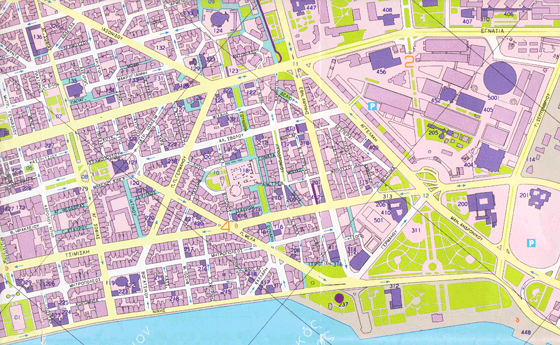 |
Thessaloniki Cultural Capital of Europe - 1997. Rare |
EU Cities
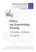
The map of the Cities of European Union - Civitates Unionis Europae, with city-names as written in the language of each country and as written in Greek. Full-colour-print; 100x70 cm; (el); one-sheet, one side; 1:7,000,000; 2002. Rare
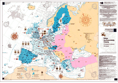 |
| Civitates Unionis Europae, 2002. Rare |
A new version of this map with new design and editing, Cities of European Union 2004 - Civitates Unionis Europae MMIV, with city-names as written in the language of each country and as written in Greek. Full-colour-print; 100x70 cm; (el)(en); one-sheet, one side; 1:7,000,000; 2004. Rare
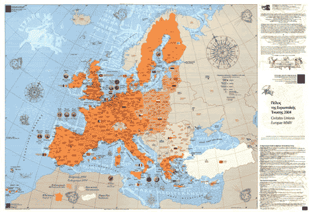 |
| Civitates Unionis Europae MMIV, 2004. Rare |
Holy Mt Athos
The map of Holy Mount Athos produced to follow the relevant book (see the list in the Book-section). This map has a later version, slightly elaborated as requested from another agency. Full-colour-print; 100x70 cm; (el); one-sheet, one side; 1:50,000; 2002
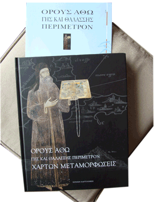 |
| The book on H. Mt Athos cartography, with the annexed map, 2002 |
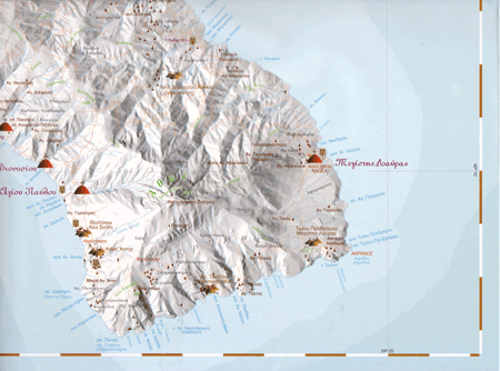 |
| The H. Mt Athos map (part), 2002 |
Macedonia - Thrace
The map of the Regions of Macedonia-Thrace, the three Regions in North Greece (West Macedonia; Central Macedonia; East Macedonia and Thrace), designed propery for administrative purposes of the local, provincial and regional authorities and associated agencies. Full-colour-print; 100x70 cm; (el); three sheets, one side; 1:260,000; 2004
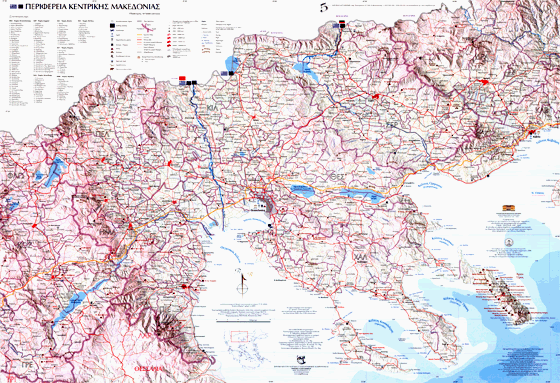 |
| The Regions of Macedonia-Thrace, in 3 map-sheets overlapped. Here the Region of Central Macedonia, 2004 |
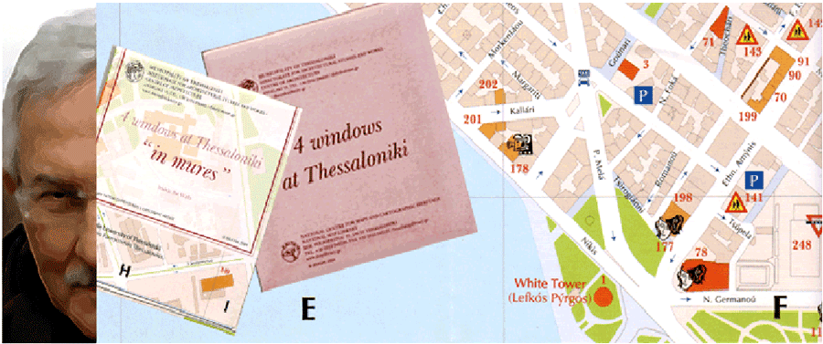
4 Windows at Thessaloniki
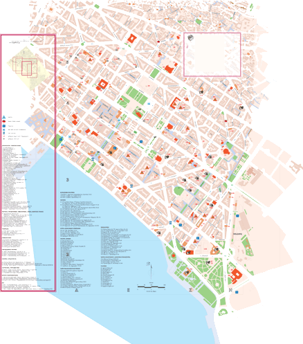
The map 4 Windows at Thessaloniki, depicting the historical Centre of the city, is following the principles applied in the 1997 relevant map. With modern graphics the map was prepared for use and distribution by the City of Thessaloniki. In two formats with each map-sheet entitled according to principal toponym or characteristic name of the depicted city-area. The map is also edited in English language with all toponyms transliterated in latinised form according to given standardisation. Full-colour-print; two formats 50x35 cm and 70x50 cm; (el) (en); four sheets, two sides; 1:4,000; 2002(el) 2003(en); in two pocket-size folders (el) (en). Highly demanded; close to rare
 |
| Detail of the version in (en) of the four-sheet map 4 Windows at Thessaloniki, with standardised names in latin lettering, 2002(el) 2003(en). Almost rare |
 |
| A map-sheet of the 4 Windows at Thessaloniki, 2002. Almost rare |
Special maps
Some special types of maps are also part of the map-production activity, as it is the map composed by the single island-depictions in the Benedetto Bordone's Isolario, 1528 referred to the Archipelago, i.e. the Aegean Sea and the Ionian Islands. The images of all islands, including the Peloponnesus (Morea) and the Holy Mt Athos peninsula, are best-fitted onto present-day relevant representations, obeying the properties of conformality (conservation of shape - alteration of orientation and scale). The result is a new synthetic "meta-historic map" associated to a modern map, on which the depictions of the single islands are now spatially collocated on a modern georeferenced map base. Full-colour-print; 70x50 cm; (el); one sheet, one side; 1:1,760,000; 2000. Rare
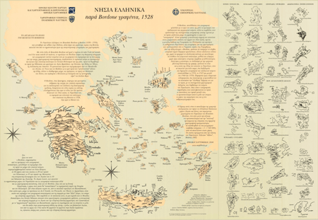 |
| The islands in Bordone's Isolario geospatially placed on a modern reference map, obeying a best-fitting conformality transformation (keep the shape - alterate the orientation and the scale) |
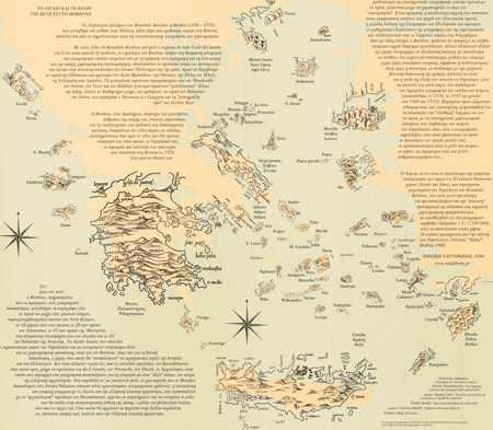 |
| Focusing the area with the geospatial placement of the islands in Bordone's Isolario |
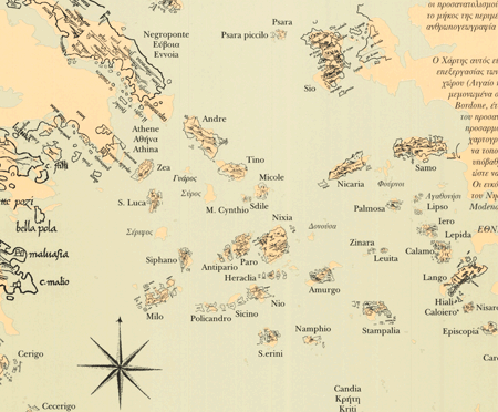 |
| Focusing the area of Cyclades |
Another example of special maps are shaded relief panoramas produced by combining the digital processing with the artistic hand-drawing. This example illustrates the Troodos mountain-massif in Cyprus
C. Boutoura, A. Tsorlini, Vasoula Nikolaidou, 2009
Stand-by maps
Many map-production projects, still unpublished, rest as stand-by and ready-to-go files. This pending files are important base-maps for a variety of implementation by just adding, in new layers, new and/or updated textual, graphic and image information on as many and as different issues are requested by the users. As an example of this potential multi-task base-maps is the following map of Corfu, prepared in 1999, but still ready for implementation finalising any map-production demand
 |
An example of stand-by map. Ready in computer disc-memory for implementation to any map-production demand. Here, the base-map of the city of Corfu, 1999
|