Cartographic Enlightenment
Compared to the Classical period, known as the Greek period the post-Medieval era of the Greek contribution in the Renaissance (excluding the story of Ptolemy's Geographia transfer from Constantinople to Florence and its influence in the cartographic thinking of the West) it is internationally classified in the minors of World's cartographic and mapping legacy. The same holds also for the Greek cartographic impact in the era of the Enlightenment. The Greek names here include the exceptional case of Nikolaos Sofianos, some portolan-makers of the Venetian school e.g. the "islanders" Ioannis Xenodochos from Corfu, Georgios Sideris/Calapodas from Crete, Antonio da Millo from the Mēlos Isl; see G. Tolias [1] [2] and the 17th-18th scholars of the Modern Greek Enlightenment e.g. Meletios, Notaras, Rigas, Gazis who commented here
Minors but important
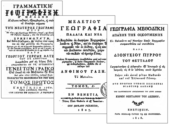
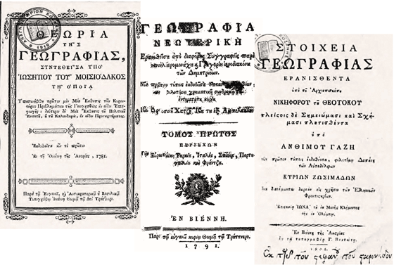
Despite the classification of this Greek cartographic presence in the minors of Renaissance and Enlighted World-cartography, for the modern Greek history associated with the national regeneration of the Greeks it is considered of highest importance for the formation, in 18th cent., of a cultural base that led to the national independence and the creation of a new state for the Greeks at the early 19th cent. The Greek cartographic enlightenment and its impact in 18th and early 19th century is of outmost importance for the Greeks who presented a worth mentioning activity in the fields of geography and cartography, following the relevant main European streams of that period. G. Tolias gives the panorama of this Greek activity in the Age of the Enlightenment with a meticulously compilation of a Catalogue. From the main personalities worth mentioning due to their outstanding impact in the case of the Regeneration of the Greeks, emphasising the need for a geographic and cartographic awaking, are selectively mentioned here Meletios (1695), Notaras (1700), Velestinlis (1797) and Gazis (1800), the first for his geographic authorship and other three especially because of their cartographic implementation
Precursors
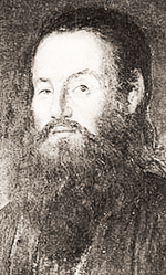
In the last quarter of 17th cent. a new generation of Greek scholars, coming mainly from clergy, is active in expressing geographic and cartographic interests with special attention for the stream of European Enlightenment and aware of the scientific advances and achievemnets in the West. Leading personalities at that time are two friends of the same age Meletios Mētrou (1661-1714) and Chrysanthos Notaras (1663-1731) both studied in Padua and Venice reaching top positions in the hierarchy of the Greek Orthodox Church, the first as the bishop of Athens and the second as the patriarch of Jerusalem. Both perceive soon the spirit and the role of the new European geographic and cartographic thinking. Meletios, called the Geographer for his outstanding geography-writings and Chrysanthos in his late thirties is already in Paris at the Observatoire. Between 1692 and 1696 Meletios, the precursor, at that time bishop at the episcopacy of Lepanto/ Naupactus and Arta, wrote a four-volume geography book on Ancient and Modern Geography a compendium of which was published in Venice in 1728 with an engravement by the Venetian Francesco Zucchi (1698-1764) [w] who was engraving for Giambattista Tiepolo
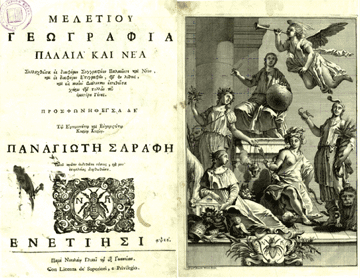 |
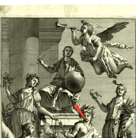
The engravement of Francesco Zucchi (1698-1764) in Meletios' compendium of his older original Ancient and Modern Geography - Source: Kozani Municipal Library |
The Meletios' work becomes the foundamental text-book on geography at the schools of Greek language in 18th cent. Much later, in 1807, Anthimos Gazēs/Gazis working in Vienna reissues the Meletios' volumes again in Venice. The prominent geographer and cartographer Barbié du Bocage sites and uses extensively Meletios' geographical work for the compilation of his maps of Greece in early 19th cent., as did many other well known travellers in Greece (e.g. Pinkerton, Byron, Leak, Hamilton, Pouqueville, Müller, Cramer)
Chrysanthos Notaras
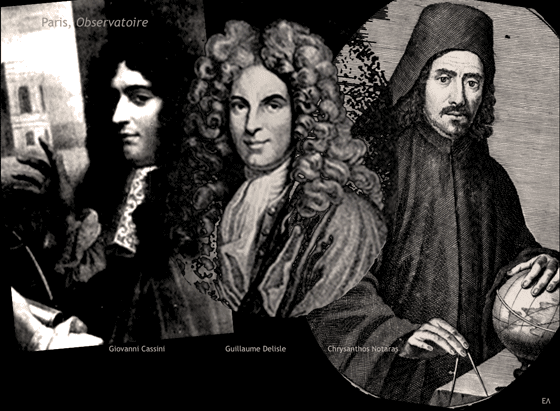
His distinct position in the Greek cartographic enlightenment is mainly due to his two maps of 1700 printed in Padua, the first in Greek writing in the modern era. Notaras is a very particular personality with outstanding mobility all over Europe and the Middle East (e.g. Wallachia, Moldova, Moscow, Vienna, Venice, Padua, Paris, Bucharest, Kiev, Constantinople, Palestine, Asia Minor and the Aegean Sea). After the studies in Padua/Venice (1697-1700) we find Notaras in Paris with the famous Bolognese professor Giovani Domenico Cassini [w] to whom (invited to Paris by Jean-Baptiste Colbert) Louis XIV mandated the birth of the new cartography as one of the statutory objectives of the Académie and the associated Observatoire, at the time when the famous cartographer Guillaume Delisle [w] was also there!
The map's dimensions are 87X54 cm and it was the first printed in Greek language. As it is stated in the Greek title and the Latin subtitle of the map, it is dedicated to the important ruler of Wallachia Iōannē Kōnstantino Vassarava, the well known Constantin Brancoveanu, depicted on the map with his coat of arms above the two hemispheres. Around the map, there are notes in Greek, astronomical diagrams and other drawings of navigation instruments
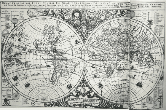
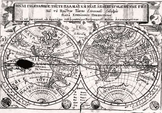
A smaller map of this type with the same title but without the decorations and the dedication was also prepared by Notaras and published in Padua the same year (1700). This map is included in his geography manual titled Chrysanthou Notara Eisagōgē eis ta Geōgrafika kai Sfairika (Chrysanthos Notaras' Introduction to the Geographical and Spherical) published in Paris in 1716, dedicated to Scarlatos Mavrocordatos, son of Nicolaos Mavrocordatos, the first Greek prince of Wallachia. More about Notaras' maps and on the similarity of his smaller map with a Sanson-derivative map by Jan Luyts' (1692) are given by E. Livieratos et al, 2011
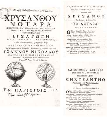 |
Chrysanthos Notaras book printed in Paris 1716, after his sojourn there, next to Cassini and other masters at the Observatoire - Kozani ML |
Rigas Velestinlis
Rigas Velestinlis (1757-1798) cartographic contribution and especially his masterpiece the Charta is well documented in a special issue of 2008 e-Perimetron with the relevant list of references
 |
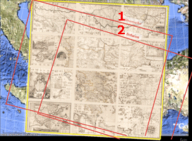 |
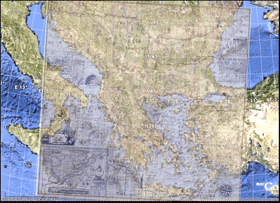
| The geographic window (geographic coverage) of Rigas Charta (left) and the geospatial correspandance of Charta's geo-window with the 1514 Waldseemuller's map (1) and of the 1545 Sophianos map (2) - cf. Livieratos |
The important case of Charta's various printed versions is also treated in this website proper section. Rigas Charta it is considered the cartographic milestone of the Greek cartographic enlightenment
Anthimos Gazis
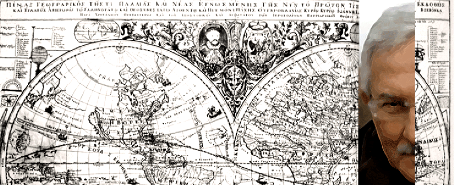
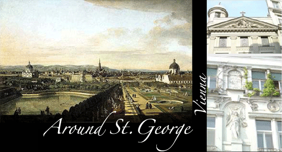
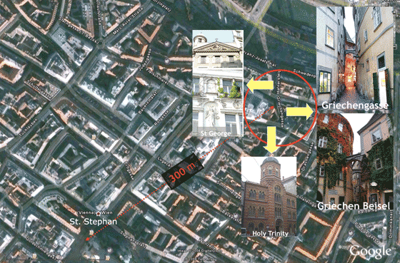
A great scholar of the Modern Greek Enlightenment, also born Thessaly as Rigas a year before, Anthimos Gazis (1758-1828) [w(el)] after ordained priest he was the parson of St. George Greek Orthodox Church in Vienna, 1797, when Rigas published his Charta. Two years after he translated into Greek and published Benjamin Martin's Philosophical Grammar of Philosphical Sciences printed by Franz Anton Schrämbl, the famous Vienna printing house known for the first World Atlas printed in Austria Allgemeiner Grosser Schrämblischer Atlass; E. Livieratos, 2008 (el). The map sheet of Greece in this Atlas was engraved by Schrämbl's brother-in-law Karl Robert Schindelmayer, the same who engraved the rare Gazis' World Map, 1800. In 1811, Gazis supported by the Philological Society of Bucharest, founded by the active Metropolitan Ignatios of Walachia [w(el)] to establish and edit at the same year in Vienna the first periodical in Greek language, Hermes o Logios (Hermes the Instructed) [w]. In 1813 he was elected a Member of the Bavarian Academy of Sciences. His efforts were concentrated to the development of a higher education system in Greece where physical sciences (astronomy, geography) would play a basic role
 |
Anthimos Gazis Pinax (map), Vienna 1800; see more (el) Source: National Library of Florence |
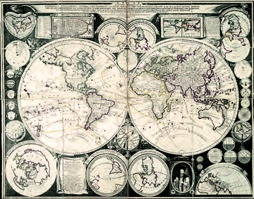 |
Antimos Gazis Atlas - World Map, Vienna 1800 - Source: National Library of Australia For the copy at the Kozani Municipal Library and its restoration at the Museum of Byzantie Culture of Thessaloniki, see (el); also(el) |
 |
 |
Rigas Charta vs Gazis Pinax
An interesting issue intriguing the historians of cartography is the relation between the Rigas Charta and the relevant Gazis map/Pinax both depicting the same geographic area but in different scale, thus in different physical dimensions, 4 sq. m the areal dimension Charta vs 1 sq. m that of Pinax. This controversial issue was solved in 2008, see E. Livieratos and discused in a proper section of this website
 |
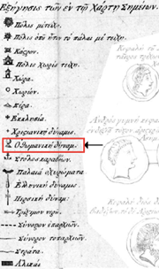 |
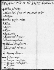
The explanation of symbols list in Gazis' Pinax 1800 (left) and the relevant list in Rigas Charta 1797 (right). Gazis neglects the symbol "Ottoman power" in his map |
It is now proved that Pinax is a different map standing for its own in the panorama of Greek cartographic enlightenment
Major reference places
The two European cities (among others) that mainly evolved the Greek cartographic enlightenment was first Venice and Vienna later. In both cities flourished Greek communities and active printing houses in which the most importatont geography books and maps were printed
In Venice, this printing activity started early, in the mid-late 15th cent., with the Cretans Laonikos and Alexander (1486) whilst Markos Mousouros, Arsenios Apostolios and Ioustinos Dekadios are associated with Aldo Manuzio's printing. At the end of 15th - early 16th cent. the Cretans again, Zacharias Kallergis and Nikolaos Vlastos (1499) are active in publishing important works supported by the wealthy and well-respected in Venice and elsewhere in Italy Byzantine noble lady Anna Notara, followed by Andreas Kounadis.Nikolaos Glykys (cf. Nicolò Glichì), from Ioannina, is the next important step in the Greek printing legacy of Venice starting his workshops in 1670. He is the publisher in 1728 of Ancient and Modern Geography based on Notaras voluminous work with the extraordinary engravement by Zucchi. Glyky's legacy was live in Venice to the mid 19th cent.; at the same lines developed relevant activities Nikolaos Saros and later Dimitrios and his son Panos Theodosiou, also from Ioannina who published geography books in Greek, by Greek scholars, as also did other Venetian publishers e.g. Antonio Zatta [w(it)] very active in map engravement and printing
The Greek publishing of geography books and maps in Vienna started later in the second half of 18th cent. Vienna and Venice made a dipole in this specific cultural activity of the Greeks in the context of the Modern Greek Enlightenment. The publishing/printing capacity in Greek of Johann Thomas von Trattner (1717-1798) [w(de)] is a focal point here having their books published leading personalities of the Greek enlightenment like e.g. Iōsēpos Moisiodax 1781, the Dēmētrieis (the Lalande and Barbié du Bocage student Daniēl Philippidis [W] and Grēgorios Kōnstantas) and Rigas Velestinlis. Also the publishing/printing facilities of Josef Baumeister and of the Greeks Georgios Ventotis/Wentotis, the Makrides Pouliou brothers and Polyzois Lambanitziotis, among others, are actively used for the publishing of geography books in the Capital of Habsburg Empire. In Vienna also engraved and printed Rigas Velestinlis and Anthimos Gazis their maps, the cartographic references of the Modern Greek Enlightenment
A Catalogue
A lengthy Catalogue of the maps printed in Greek language during the Age of Enlightenment (1665-1820) is given by G. Tolias, 2010
Restoration of the rare Anthimos Gazis World map
The only existing in Greece (Kozani Municipal Library) rare World map by Anthimos Gazis (Vienna, 1800) was safely restored in 2008 by the restoration team of the Thessaloniki Museum of Byzantine Culture, under Dr. George Boudalis, thanks to the generous decisions made by the Museum Director Dr. Anastasia Tourta
, Kozani Municipal Maplibrary]")
Dr Anastasia Tourta (middle) with Dr George Boudalis (right) and Evangelos Livieratos in front of the restored Anthimos Gazis World map
Relevant book
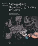 |
A relevant book (in Greek): E. Livieratos 2009, Cartographic Adventures of Greece, 1821-1919. Athens: MIET-ELIA, Publications Dept. , p. 287, 240x300 mm, ISBN 978-960-201-194-2 | Contact: mietekd<at>otenet.gr | miet2<at>otenet.gr |