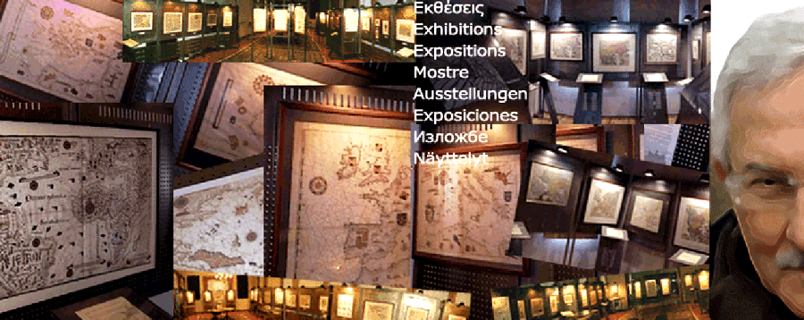


Exhibitions
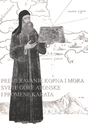
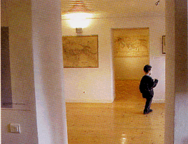
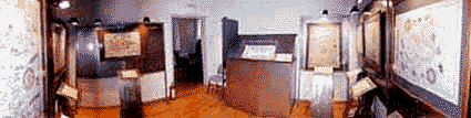
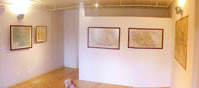
Two and a half years after the starting of the professorship at Thessaloniki at the Chair of Higher Geodesy and Cartography, SRSE - AUTH, he organised in 1982 his first map-exhibition in the corridor of the sixth floor, the SRSE building at the AUTH Engineering complex. The title was 2 1/2 years of cartography with exhibits the maps prepared by students in the context of their diploma works in the courses of general-, thematic- and mathematical-cartography
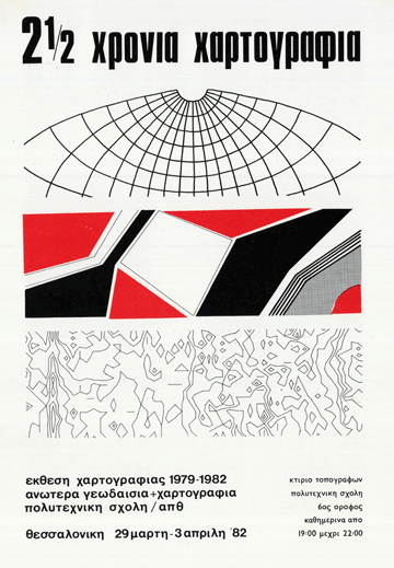
This setting-up of a small in-house exhibition, enthusiatically prepared to demonstrate the work done in few years (1979-1982), aimed at the encouragement of the students, stimulating their interest for the newly introduced systematic cartographic studies in the SRSE - AUTH. The visitors were mainly students from engineering and geosciences and university professors (recalling some dear colleagues from Architecture considered "disrespectful" to Federico Fellini the use of 1/2 in the title!)
 |
Map-exhibition alone |
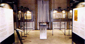
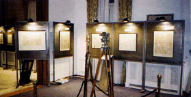
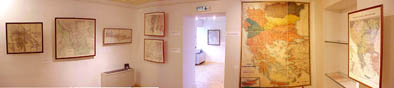
The involvemenet in the organisation and direction of really demanding map-exhibitions, addressed to the general public the professional way, started much later within the institutional frame of the work at the Centre for Maps and Cartographic Heritage (the Centre) in the late 1990s. As examples, are listed here some selected map exhibitions organised in association with domestic and international institutions
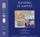
Histories on maps, 1998 |
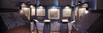
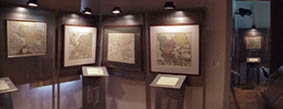
The first map-exhibition of the Centre with variable content was organised with the cooperation and support of the BnF - Bibliothèque Nationale de France for the occasion of the 80th anniversary from the end of the "Expédition de Salonique" [w(fr)] or the "Front of Salonica" [w(en)] Thessaloniki, June - July 1998
 |
| Histories on maps, 1998 |
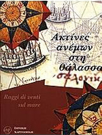
Windrays on sea, 2000
Raggi di venti sul mare. In cooperation with the Museo Correr of Venice, this outstanding exhibition brought from Venice to Greece, at the Centre, the originals of some rare manuscript portolan-maps made by the Greek mapmakers of 16th century Giorgio Sideri and Antonio Milo
 |
 |
 |
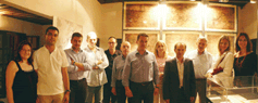
Left: C. Tonini, Correr; C. Boutoura, AUTH; F. Guerra, IUAV. Middle: Tonini. Right: G.Tolias, HNRF; F. Guerra |
The exhibition was associated with a relevant conference at the Italian Cultural Institute of Thessaloniki; Thessaloniki, January-February 2000, with the participation of colleagues from Correr Museum (C. Tonini), University IUAV of Venice (F. Guerra), AUTH (C. Boutoura), National Research Foundation, Athens (G. Tolias); Thessaloniki, January - February 2000
Germans mapping Greece, 2001
This exhibition recalls a number of German and German-speaking cartographers (e.g. Waldseemueller, Muenster, Quad, Honter, Merian, Buenting, Mueller, Cluverius, Homann, Schreiber, Scherer, Weigel, Seutter, Lotter, Harenberg, von Rhode, Euler, Kaupert, Kiepert) who depicted Greece on maps from 16th to 19th century
In cooperation of the Centre with the Goethe Institut Thessaloniki and ELIA - Hellenic Historical and Literary Archive
 |
 |
In the context of this exhibition, Dr Peter Mesenburg from Essen, addressed an invited talk on "Die Weltkarte des Gerhard Mercator (1569) -Ursprung und Genauigkeit", Thessaloniki, 17 February - 11 March, 2001
H. Mt Athos metamorphoses on maps, 2002, 2006
Following the publication of the book on H. Mt Athos cartography Mount Athos' Land and Sea Perimetre. Metamorphoses on maps, in cooperation with the Mt Athos Map Library a relevant map exhibition was invited to be held at Belgrade in November 2002
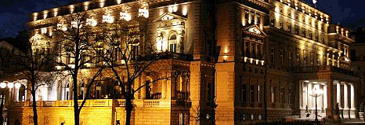 |
Stari Dvor; the old palace, now the City-Hall of Belgrade |
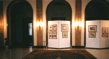 |
Stari Dvor. The map exhibition on Mt Athos, 2002 |
 |
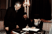 |
Left: The exhibition at the Belgrade Stari Dvor. Right: The late Patriarch Pavle of Serbia signs a copy of the book on H. Mt Athos cartography, Belgrade 23 November 2002 |
Fifty-five maps representing H. Mount Athos were exhibited at the Stari Dvor - City-Hall in sections: Athos in portolan maps; Athos in Isolarii; Athos in Ptolemy-type maps; Athos in Sevastianoff mappings; Athos by Gerassimos Smyrnakis in cooperation with Hieromonk Ioustinos Simonopetritis and the Academician Gojko Subotić. Belgrade, November 2002
This exhibition moved some years later to the North in Finland, as part of a major event, the exhibition Athos - Monastic life in the Holy Mountain held at the City Art Museum. Helsinki, August - January 2006
Cyprus at the azimuths of winds, 2003
A large map exhibition with precious historical maps of Cyprus, from the BoCCF - Bank of Cyprus Cultural Foundation prestigious Map Collection, held at Thessaloniki on the occasion of the accession of Cyprus to the European Union in 2003

|
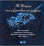 |


A special publication came with this map exhibition under the title Cyprus in the azimuths of the wind. Thessaloniki, 9-25 June 2003
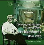
Sotiris Zisis, 2004
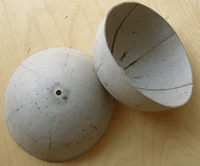
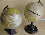
Sotiris Zisis (1902-1989), with family origins from Asia Minor, was a typesetter in a big daily newspaper of Thessaloniki from 1937 to the late 1960s. More known in the local art community as a good amateur folk painter, Zisis was also a self-learned cartographer and globe-maker, who invented and constructed upon his own mechanical designs a special machinery for globe production
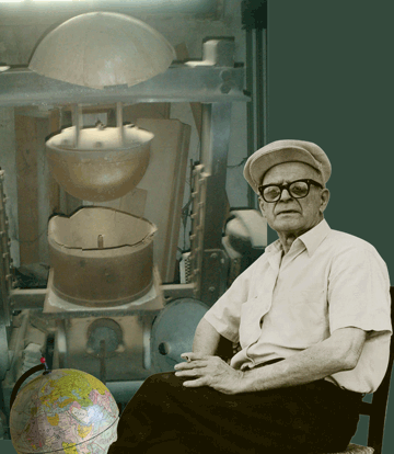 |
| Sotiris Zisis (1902-1989). A self-learned cartographer and globe-maker at Thessaloniki |
Since he was a typographer and at the same time a painter-artist he developed combined skills in preparing himself the gores for his globes
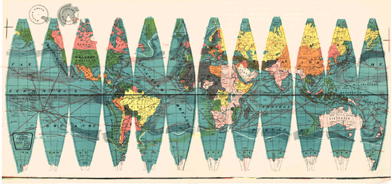 |
| The Sotiris Zisis home-made gores for his globes for school use in the 1960s |
Zisis established a proper studio-workshop in his home, producing globes for schools, together with his two daughters, in a rather professional manner improving his income for living. It is estimated that more than a thousand globes circulated in the Greek schools in the 1950s and 1960s
 |
 |
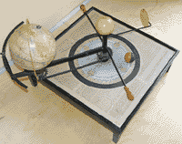 |
In paraller to this activity he was a tireless man with his creative cartographic hobbies for producing particular maps for personal pleasure as well as mechanical systems simulating the motion of celestial bodies (state-patent in the early 1950s). In the occasion of the 15th anniversary from Zisis' death the exhibition revealed and highlighted the work of this exceptional man, together with a book documenting his life. Thessaloniki, December 2004
Kozani Exhibitions, 2008-2010, 2012
In the frame of the joint project of the City of Kozani, the Municipal Library and the AUTH for the development of a Map Library at Kozani (2008-2010) a number of map exhibitions, among other synergies, dispayed the historical map collection of the Municipal Library, referred to the Age of the Enlightenment. A permanent and a number of seasonal map exhibitions made already a small but distinct history of the Kozani Map Library.
- Kozani in the World of Maps (Rigas Velestinlis; Anthimos Gazis; the "geography" of the Modern Greek Enlightenmant; Franz Anton Schrämbl, Kozani on maps, late 19th-early 20th cent.; Kozani in the maps of the refugees, 1924-1929 (el)
- Maps in the dreams of children (el) April 2009
- Satirical maps of the World and History (el) February - March 2009
- Crete travels with maps to West Macedonia (el) January - March 2010
- Holy Mount in the Maps of the Centuries (el) March-May 2010
- A new map for Kozani (el) May - September 2010
- Danube: The grand-limit in the history of maps. The 1789 mapping from Belgrade to Black Sea (el) October 2010 - January 2011
In the frame of the Cartographic Week at Kozani, 9-13 November 2012, two more exhibitions organised in the context of relevant cultural events:
- On the Map: People from West Macedonia and Kozani in Central Europe - Hungary [ 1 ] [ 2 ] [ 3 ] (el)
- From Melouna to Kozani 1912-2012 [ 1 ] [ 2 ] [ 3 ] (el)
 |
 |
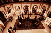
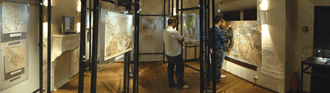
Left: The Kozani map exhibition main hall. Right: The Kozani Maior (centre) with his cooperators and the AUTH team